Bali by Motorbike
January 2006
The Batur Crater and other interior regions
Click on any image for a bigger view
contact me if you want the really high definition image
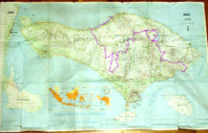 |
| Route Map |
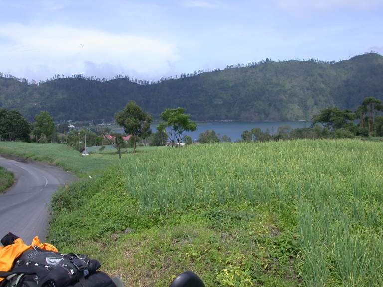
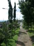
I spent my first week in Bali on the north coast
near the town of Lovina,
making brief forays up into the hills
and getting more comfortable with the motorcycle.
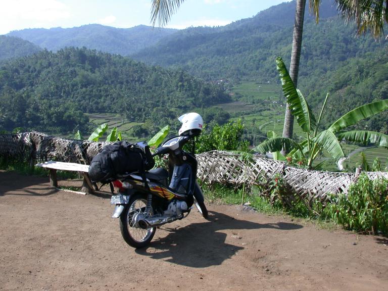
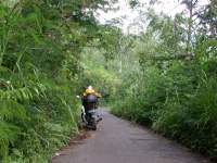
Then I strapped my backpack on the back of the motorcycle
and began wandering around the interior.
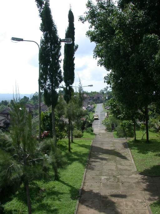
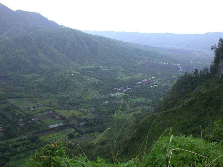
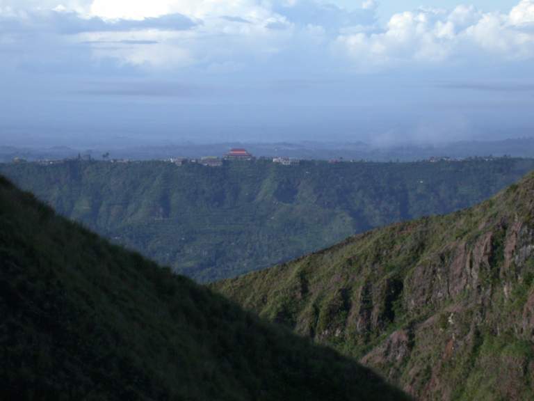
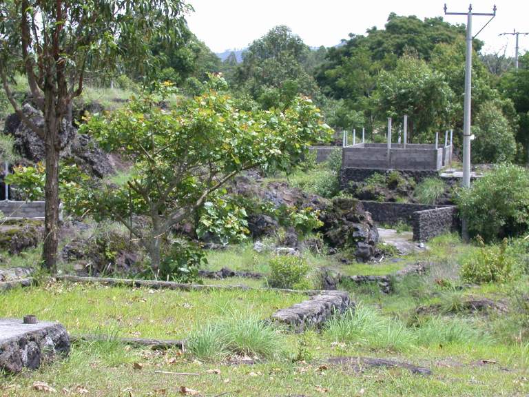
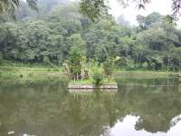
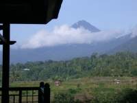
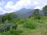
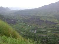
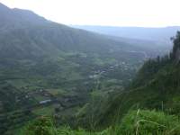
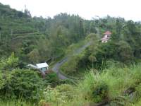
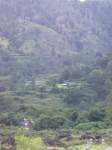
The interior of Bali is dominated by several large, old, volcanic craters
now containing gorgeous lakes.
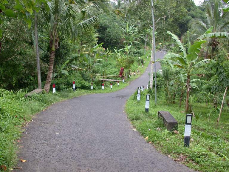
But before I got to them I had to do a little ridge running.
I was fortunate; the day dawned clear,
and I had a spectacular ride.
 |
| Bike Packed for Moving |
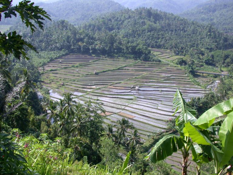
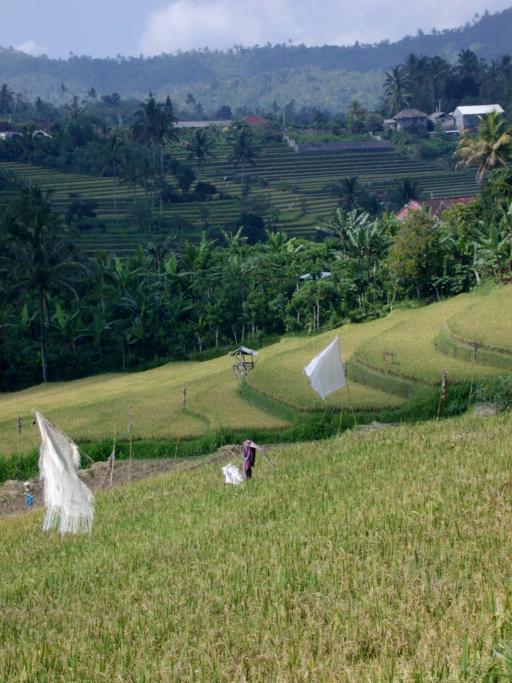
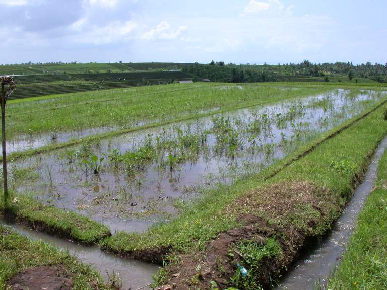
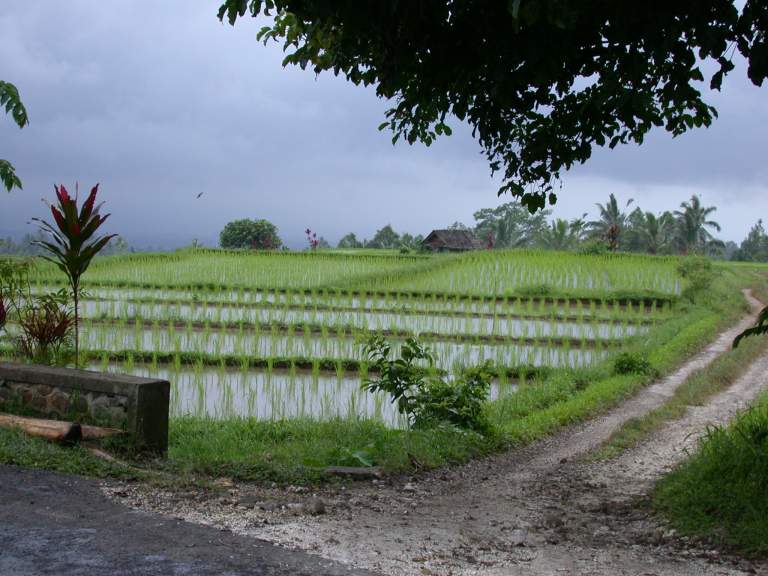
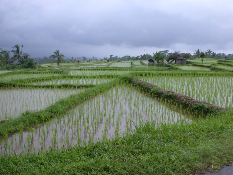
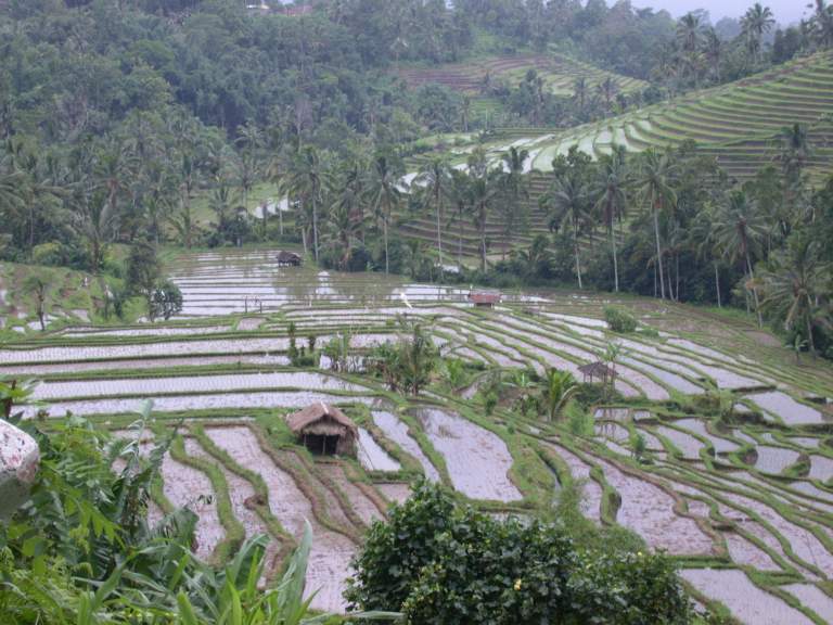
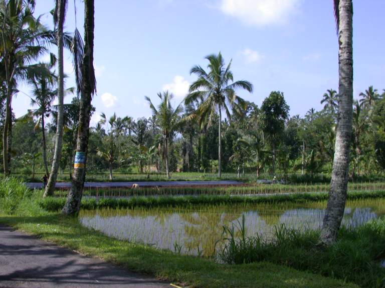
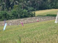
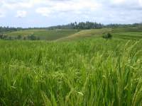
When the rice paddies were flooded,
they made incredible patterns on the landscape,
and it is then that one most easily sees how incredibly intensely
the hillsides have been pushed for agricultural purposes.
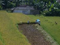
Almost everything in the rice fields is done by hand.
I suspect this is partly because of the small size of the paddies,
and partly because of the (usually) steepness of the terrain.
The rice is cut by hand, stacked in small bundles,
and carried to a central collecting place.
After the rice kernels are removed,
the stalks are piled and burned along with the fields.
 |
 |
 |
| Harvesting Rice |
Ready for Burning |
Ready for Harvest |
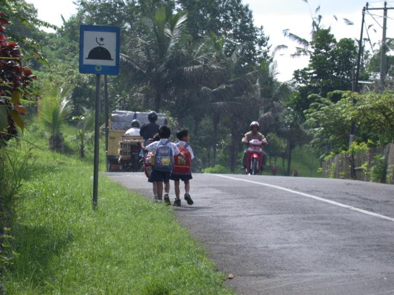
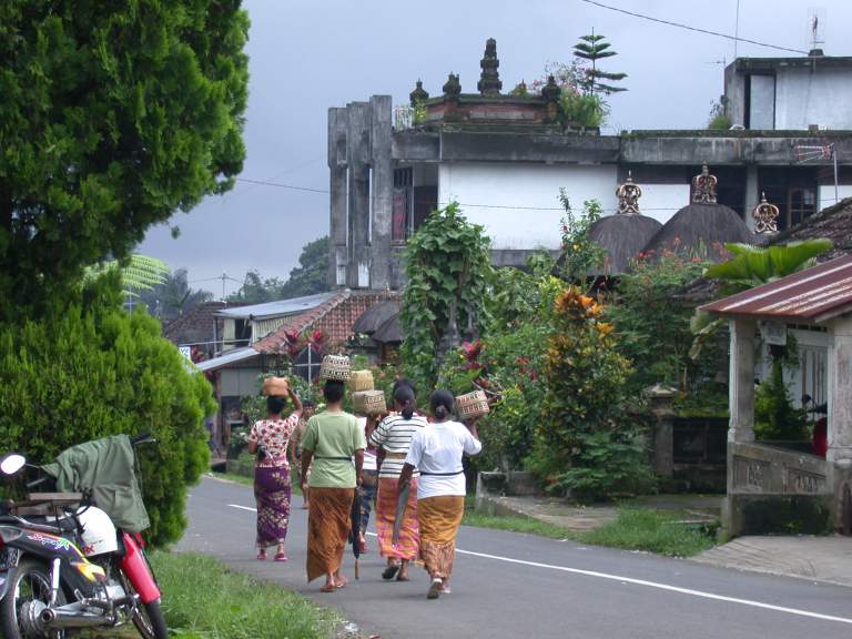
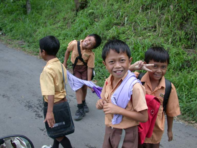
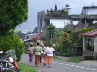
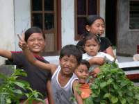
One of the things I enjoyed most about Bali
was watching kids going to and from school.
I'd often meet small scattered groups of kids
walking, playing, hopping and skiiping,
carrying their small packs with school materials.
They always smiled and grinned and waved and yelled "Hello".
I would slow down to a crawl
and stick out my hand
and clap theirs as I went by.
Then one day I had a small bag of individually wrapped candies with me,
so I stopped and gave one to each child.
They were ecstatic,
and from then on I made sure I always had a bag handy.
I wish I had had something a little more healthy,
like dried mangos,
but I didn't, and couldn't find much at the stores.
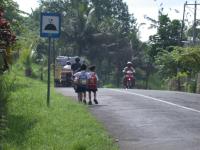 |
| School Kids |
 |
 |
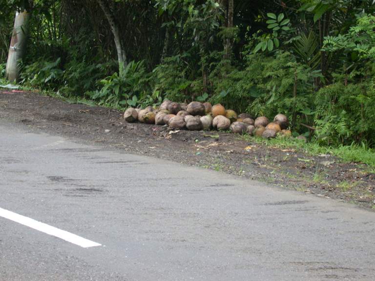
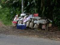
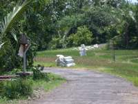
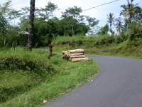
| Freight Waiting for Pickup |
Coconuts Waiting for Pickup |
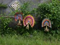 |
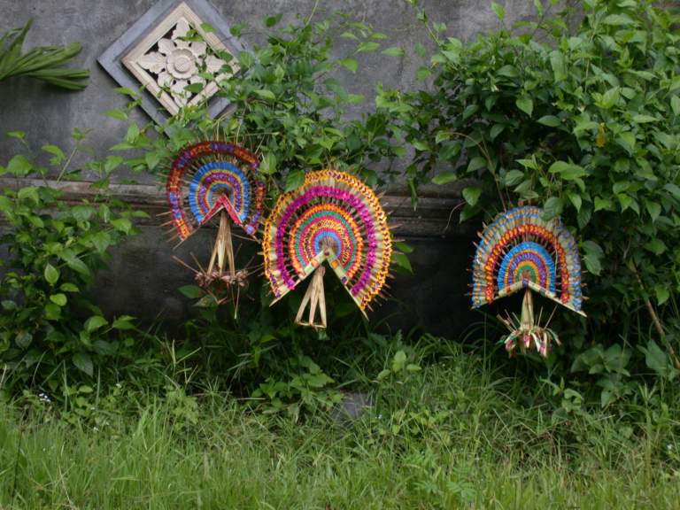
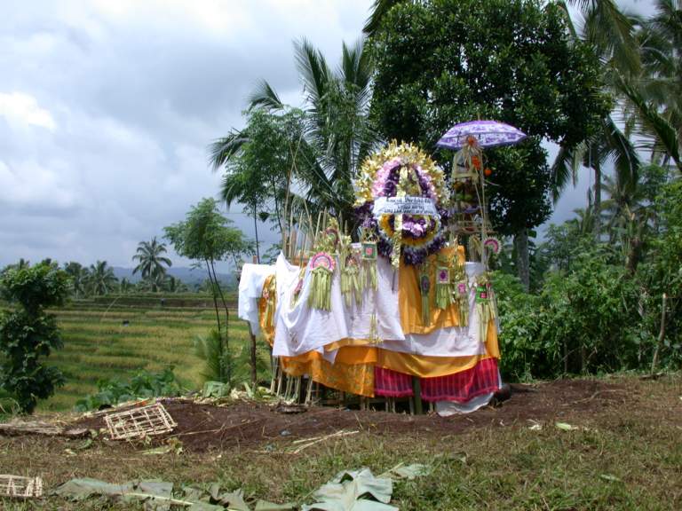
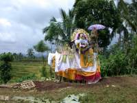
| Roadside Blessings |
Eventually, I took what I considered a wrong turn.
I was trying to contour my way around one of the big Volcanos,
but went too far down the ridge I was on.
I ended up in a gentler terrain,
what I labelled as "Rice Kansas".
It wasn't too much of a problem.
Not wanting to backtrack and miss the opportunity to see something different,
I just took the next road over to the next ridge,
and headed back up.
 |
 |
| Rice Kansas |
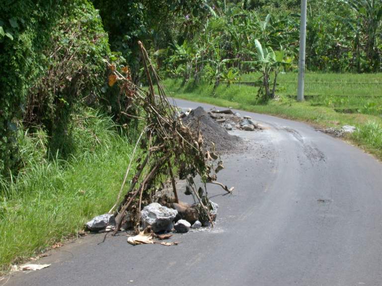
They have those warning triangles
you put out in the road
when you have an accident or a road hazard,
just like here at home.
But you have to learn to recognize them -- a tepee of sticks.
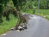 |
| Road Hazard Warning |
 |
 |
 |
 |
 |
| Burial Blessing? |
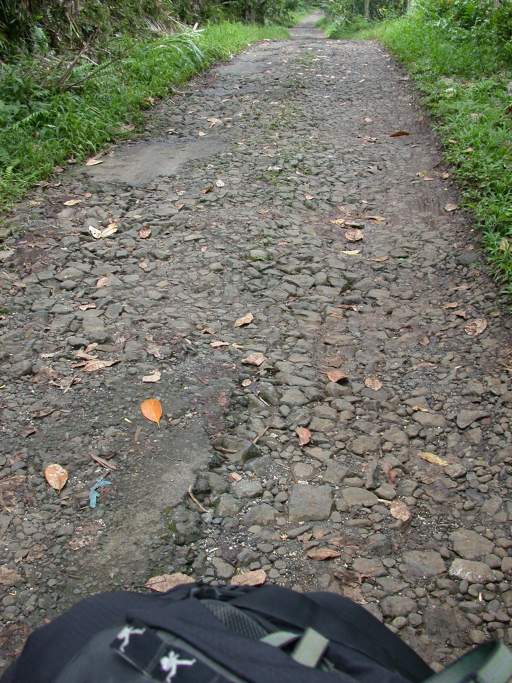
Deteriorating Road |
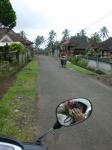
Gary in the Rear View Mirror |
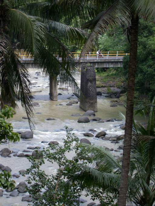
Rice Freight Depot |
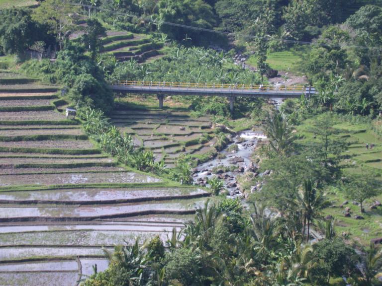
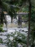
Bridge and River |
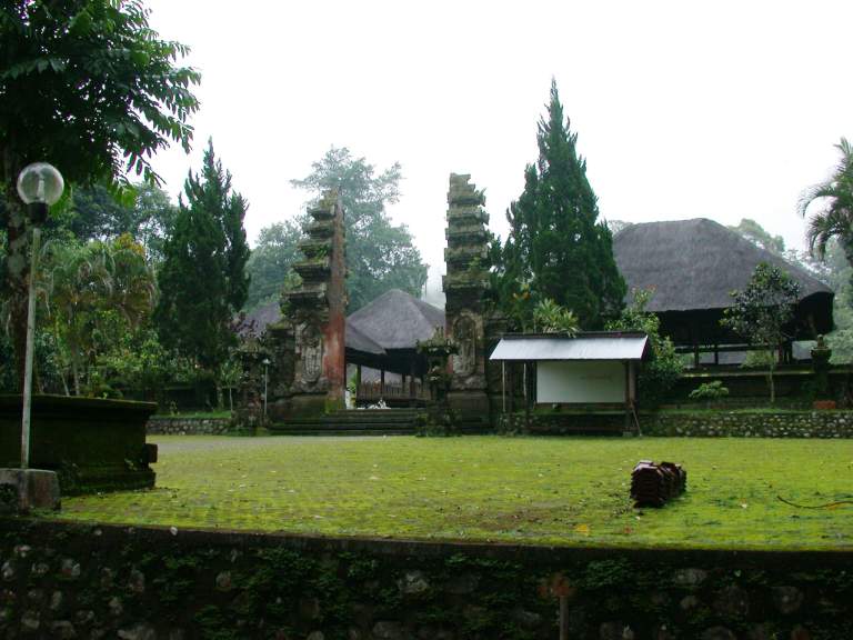
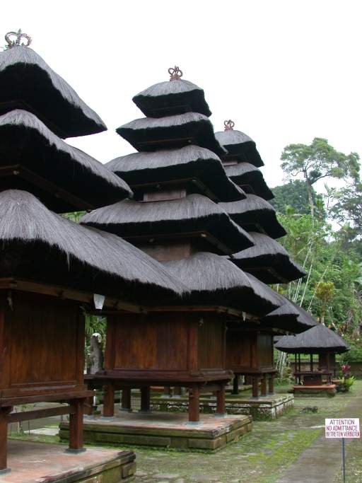
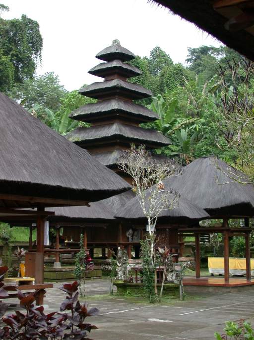
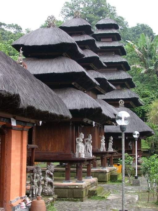
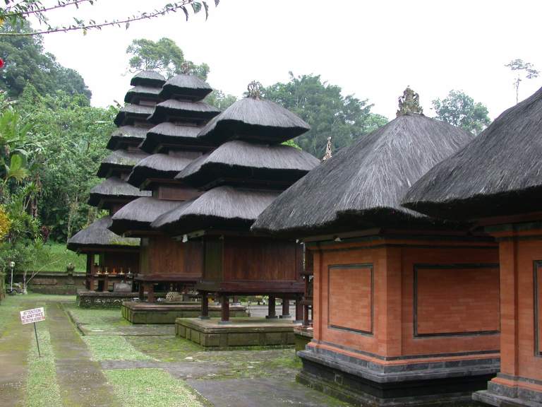
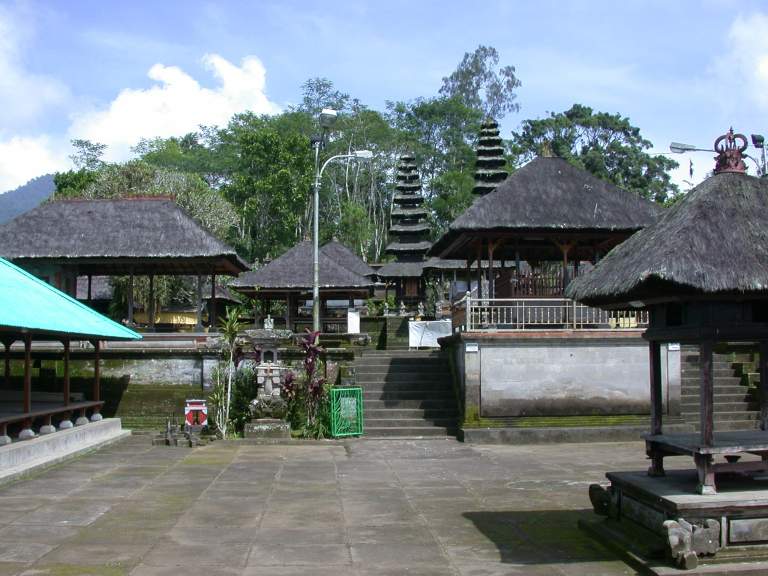
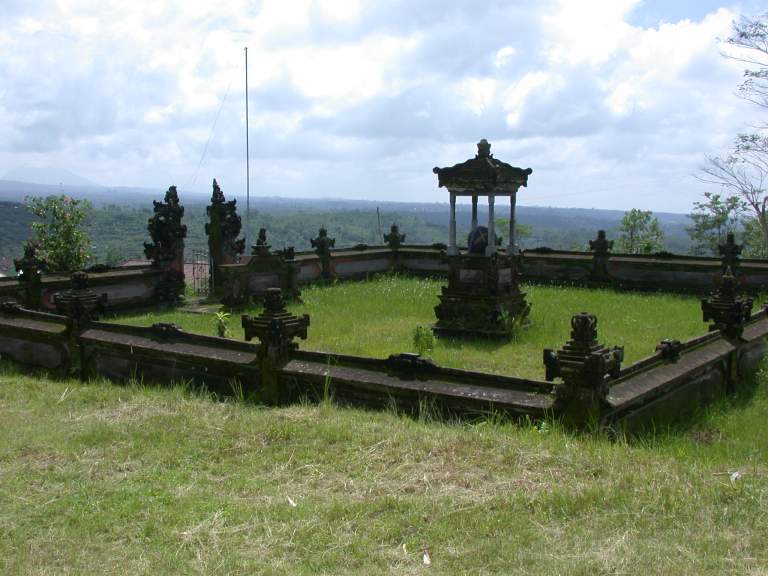
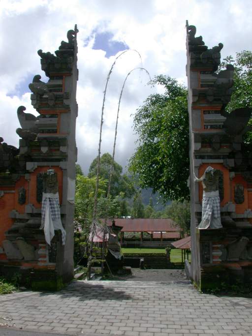
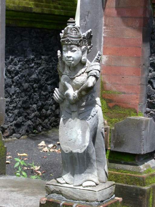
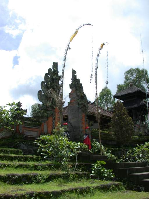
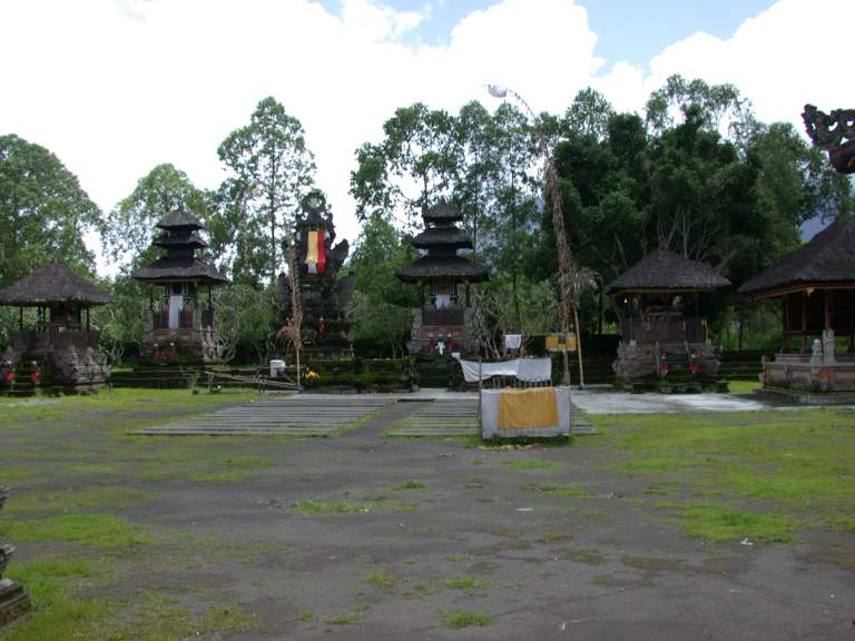
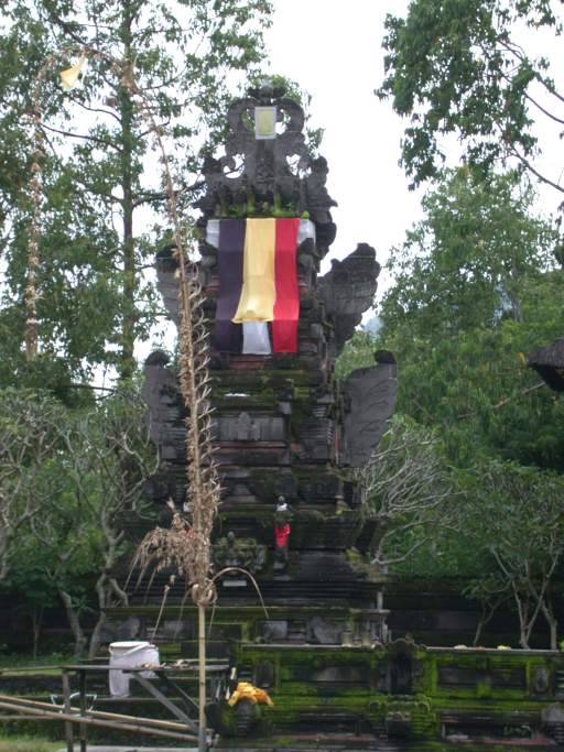
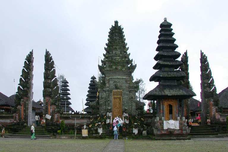
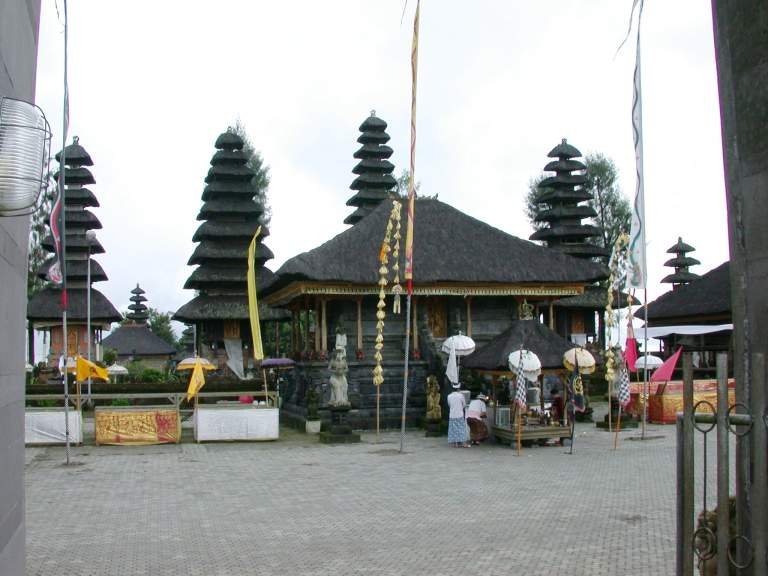
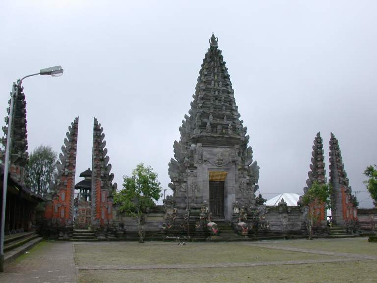
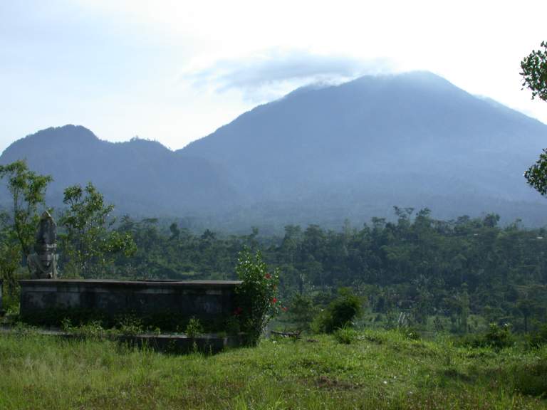
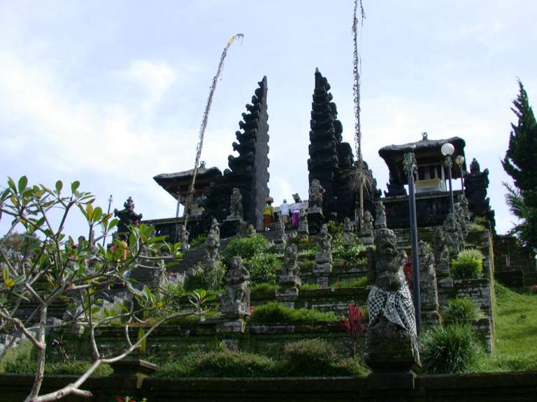
I went to Pura Luhur Batukau,
one of the more well-known Hindu temples.
It is located part way up the second highest volcano,
and a trail to the top of the volcano goes through the jungle from there.
I was originally planning on climbing the volcano,
but the weather was not particularly good
and it didn't seem like the right thing to do at the time,
so I just toured the temple.
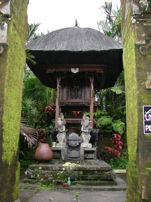
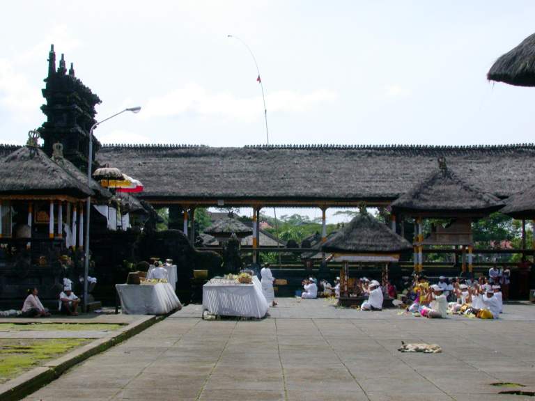
Unlike the Buddist temples,
which have gold plated statues of Budda inside ornate buildings,
the Hindu temples are predominantly outdoor affairs.
All of the worshipping I saw happened outside,
and the covered areas were used only for preparation of some sort.
The number of roofs has some significance,
but I can't remember what.
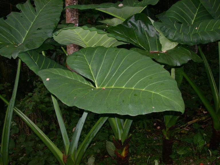
The grounds at Pura Luhur Batukau were pleasant;
there is a nice pond and just walking around was soothing.
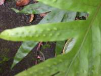
I came across an arrow-leaf like plant with huge leaves,
about three feet across and five feet long,
and another plant which some kind of bug had laid its eggs in,
making a decorative pattern of bumps.
 |
 |
 |
 |
| Ornate somethings... |
Pond at Pura Luhur Batukau |
Huge (3' wide, 5' long leaves) |
Insect bumps on leaves |
 |
 |
 |
| |
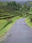
Windy road |
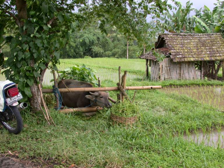
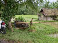
Cow in roadside pen |
From Pura Luhur Batukau,
I wound my way from ridge to ridge
until I got to the main road going north and south
through the center of the island.
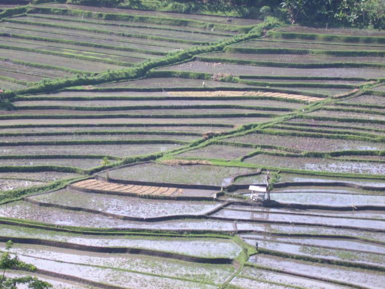
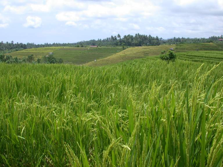
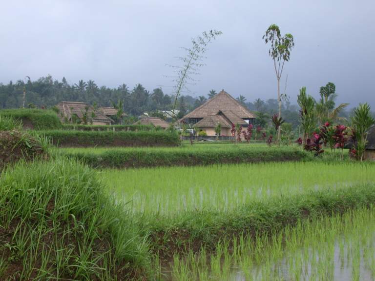
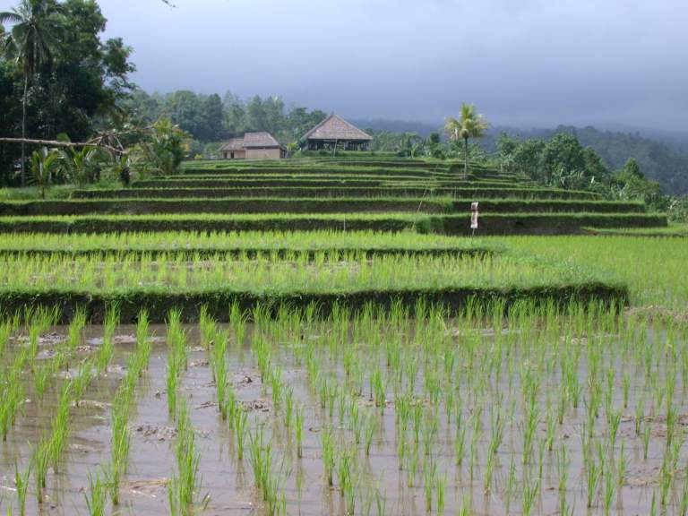
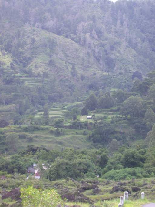
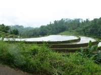
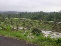
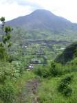
Along the way I saw some engineering marvels of rice paddies.
Several of them occupied all of the high ground on a ridge or point,
clear out to the edges.
Why they don't erode to nothing in the torrential rains is beyond me.
I read a little about it, but I still don't really understand it,
especially at the gut level.
 |
 |
 |
 |
| Rice paddy terraces |
Top of point paddy |
Entire ridge paddy |
|
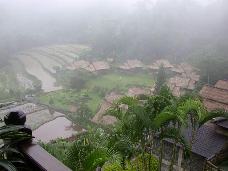
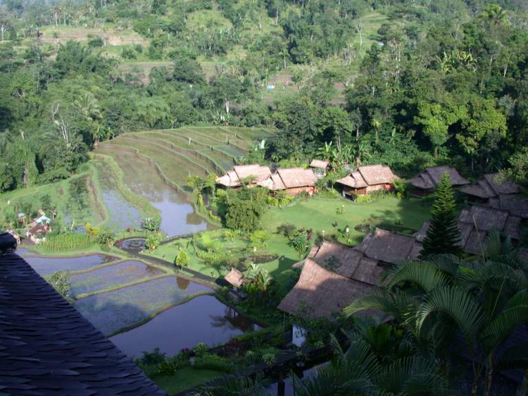
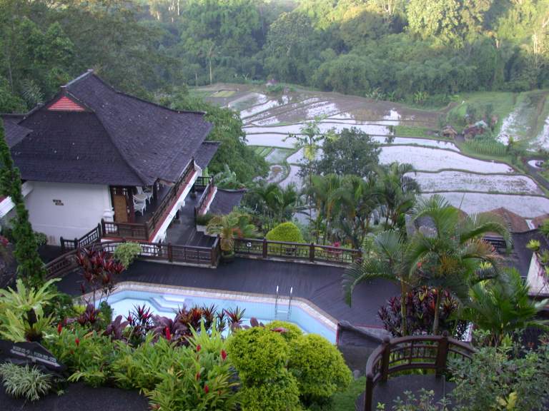
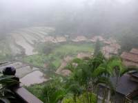
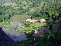
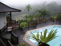
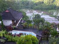
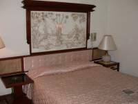
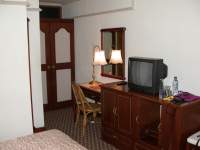
I came to the main road in the afternoon,
and the only place to stay I could see was a rather expensive hotel.
After some negotiation, I decided to stay for $30.
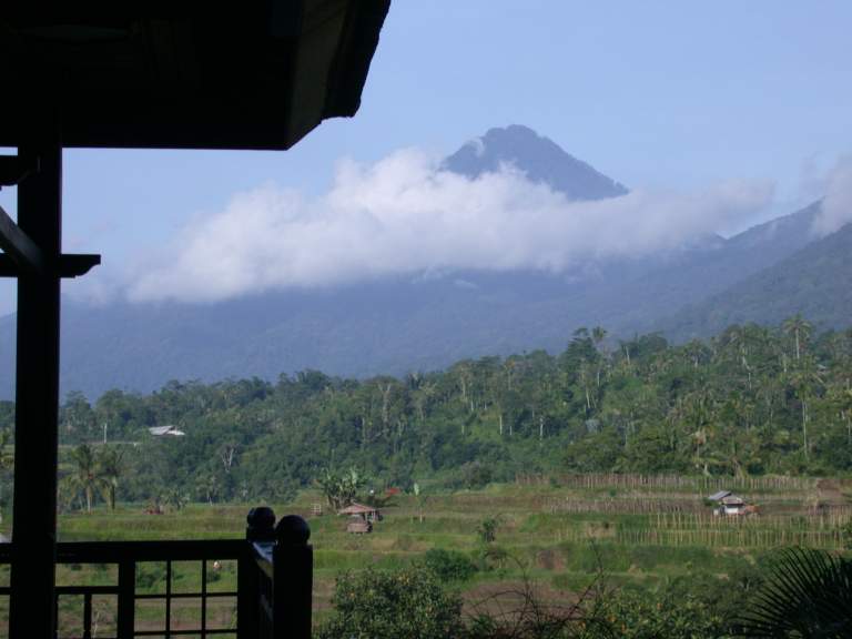
The Pacung Asri Hotel is in a nice setting,
with a beautiful view of rice paddies below
and the second highest volcano in Bali to the west.
When I arrived, it was foggy,
but by the next morning the sun was out.
 |
 |
 |
 |
 |
| Looking down from Pacung Asri Hotel |
|
Pacung Asri Hotel pool |
|
Ganung Batukau |
 |
 |
 |
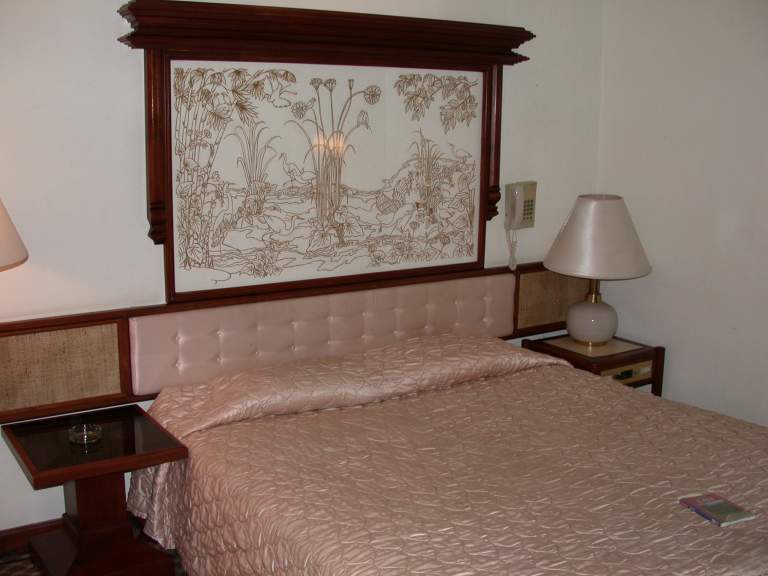
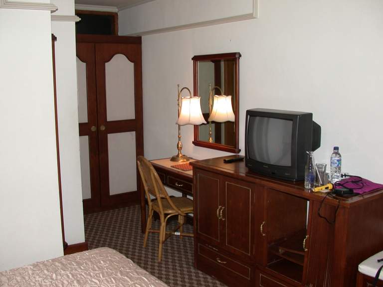
| Pacung Asri Hotel room |
|
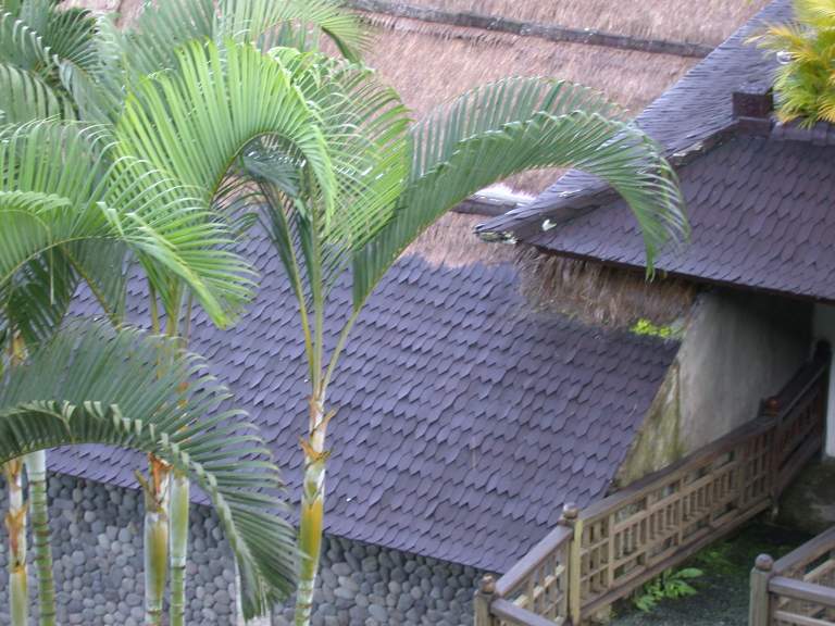
Shingles covered with thatch |
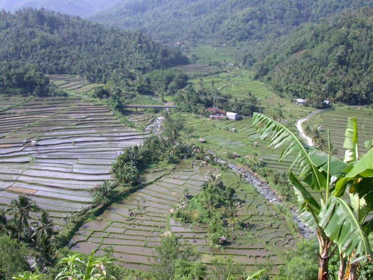
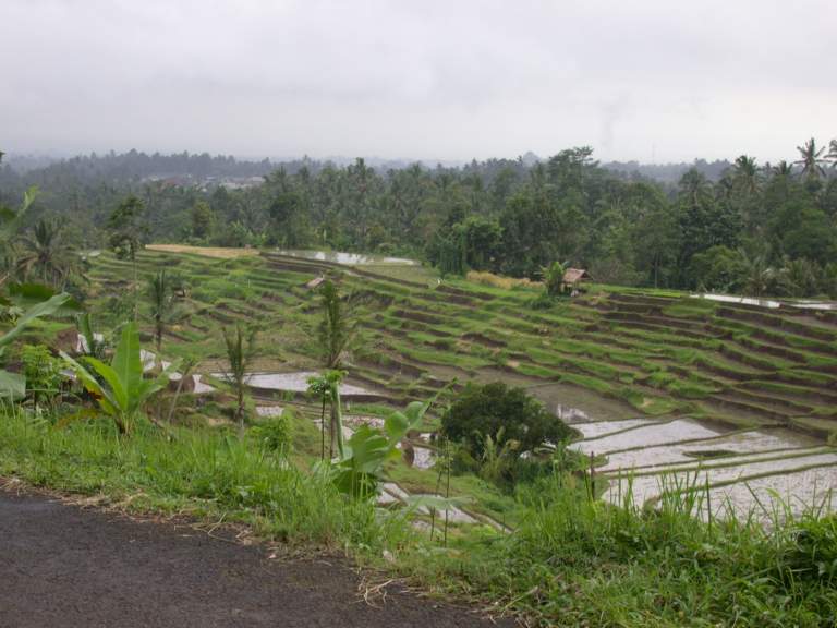
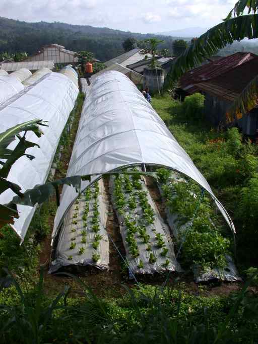
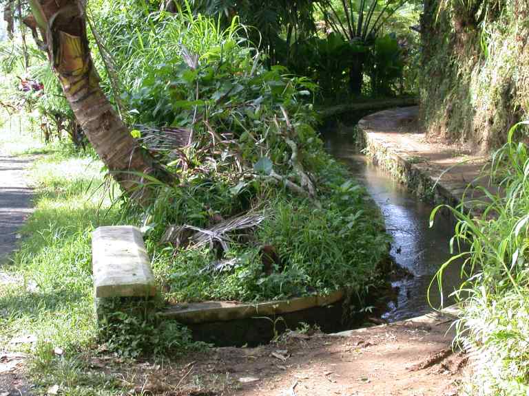
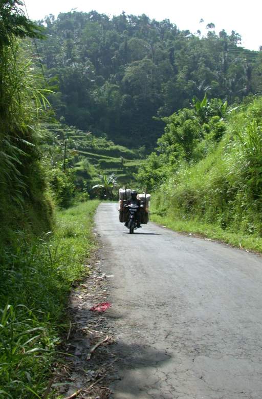
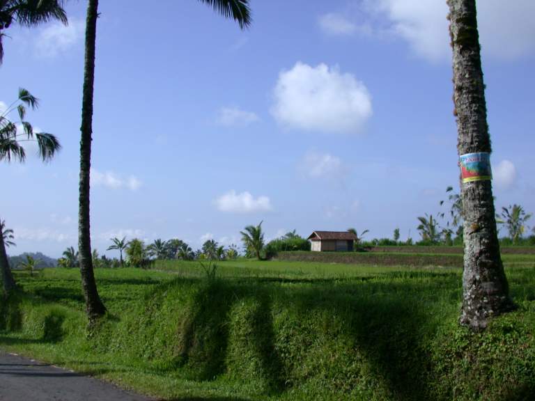
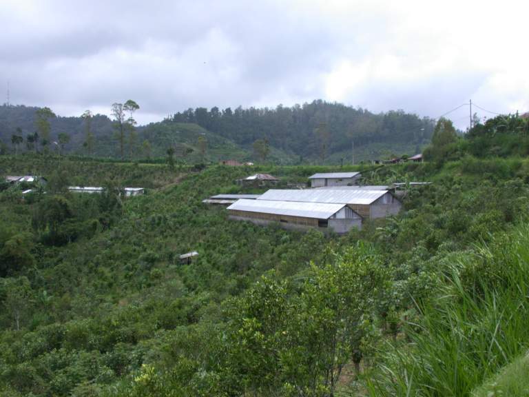
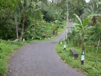
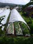
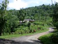
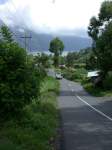
I wound my way around the countryside,
enjoying the signts.
I was continually amazed by the terraced fields,
and the amount of stuff the local folks
could carry on a small motorcycle.
 |
 |
 |
 |
| Greenhouses |
Irrigation Ditch |
Loaded Motorbike |
Jungle Road |
 |
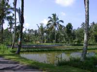 |
| Rice Fields |
Except for near the few large cities on the main roads,
gas stations consisted of a small store
that also dispensed fuel.
Gasoline was usually sold by the liter,
from plastic bottles,
or dispensed from a 55 gallon drum behind the counter.
 |
| Gas Station |
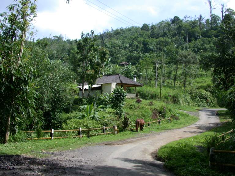
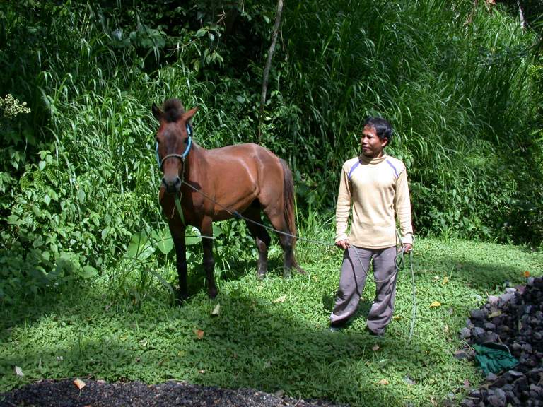
At one point I came around a corner to find a tethered horse grazing.
I stopped to take a picture,
and the owner came up and asked if I would like to go for a ride.
I knew it would cost me something,
and I had just blown two days budget
staying at the hotel Pacung Asri the night before,
so I begged off.
I now wish I had taken him up on it.
I probably would have made a friend,
learned a lot,
seen some pretty country,
and had a great experience.
 |
 |
| Horse |
Horse and owner |
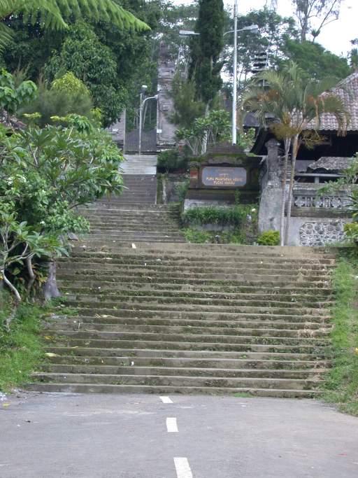
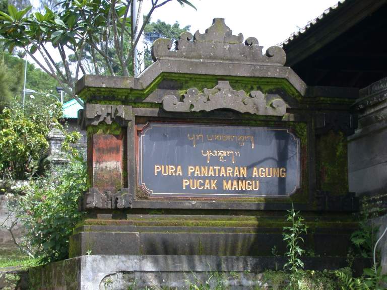
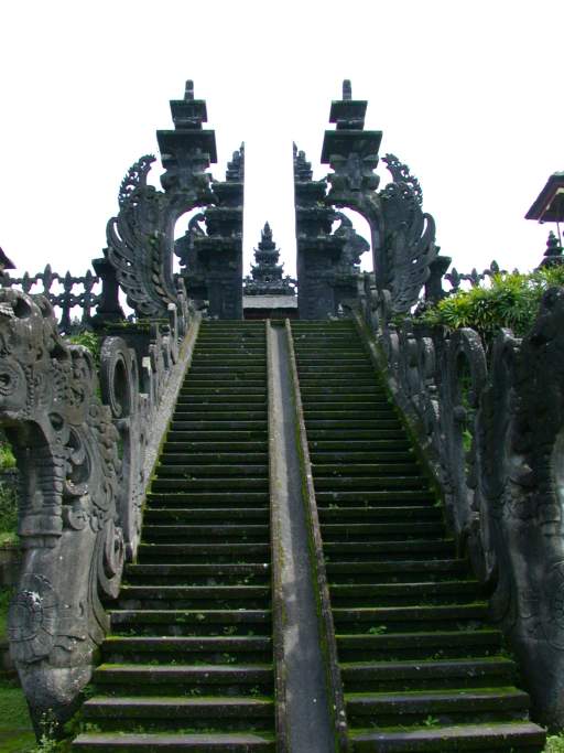
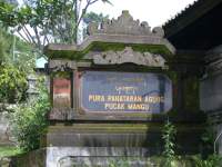
I had convinced myself that there was no such thing as a dead end road on Bali
when I came around a corner and saw my road dead end --
straight into a temple stairway.
Apparently this road led to Pura Panataran Agung,
and nowhere else.
So I toured the temple,
and then explored a bit and found that a hundred yards back,
at what looked like an alley,
the road continued on.
 |
 |
 |
 |
 |
| Dead end... |
Road from temple steps |
Pura Panataran Agung |
Temple gate |
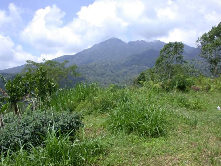
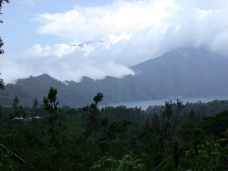
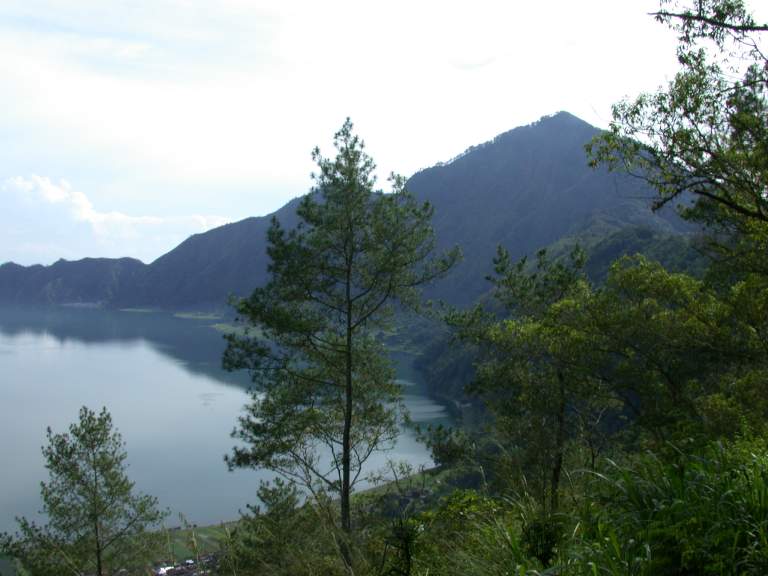
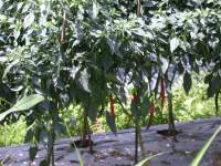
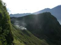
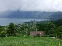
As I neared my destination,
the huge volcanic crater more or less at the center of the island,
I came to an area where the Japanese were hiding out during (and after)
world war II.
It was easy to see how they could hide there for many years,
surrounded by thick jungle in steep terrain.
 |
 |
 |
 |
| Japanese hiding country |
Hot peppers |
Roadside Temple on a point |
Ridgetop greenhouses |
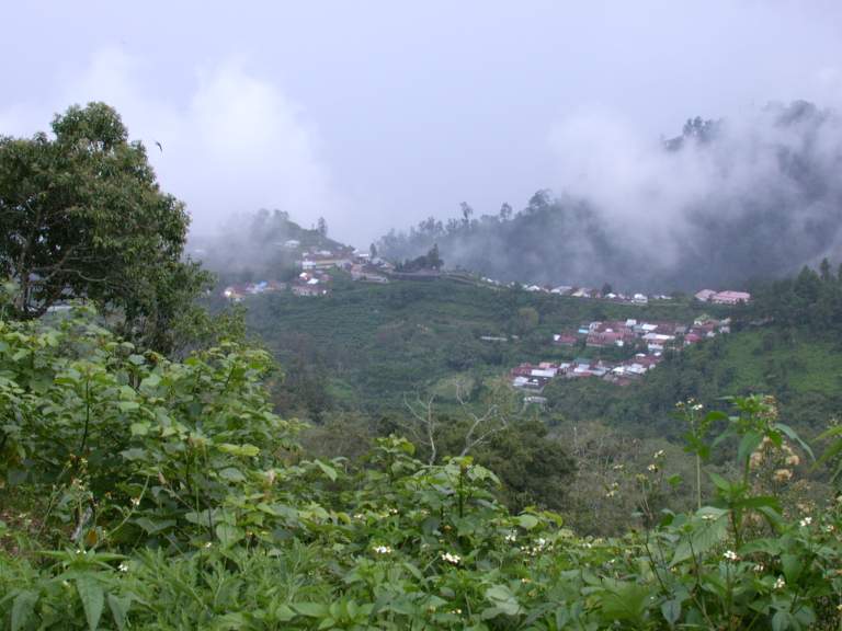
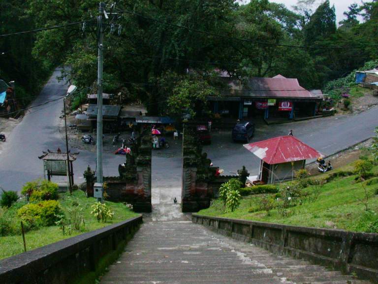
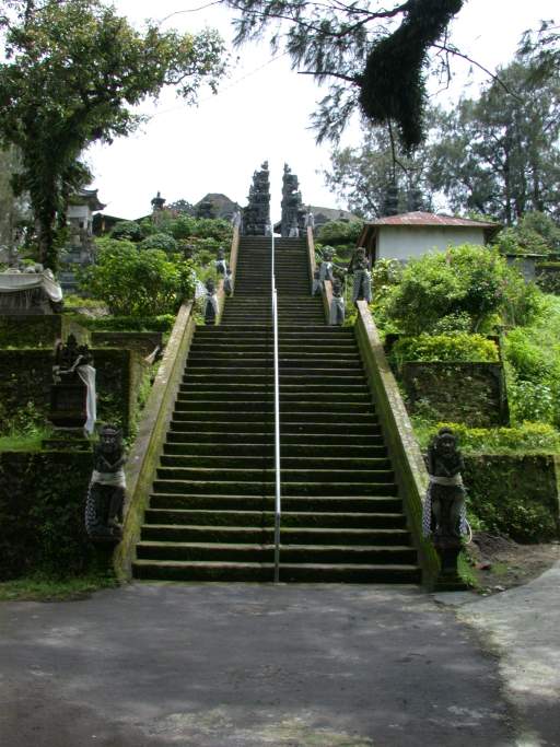
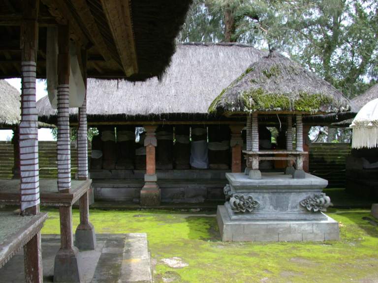
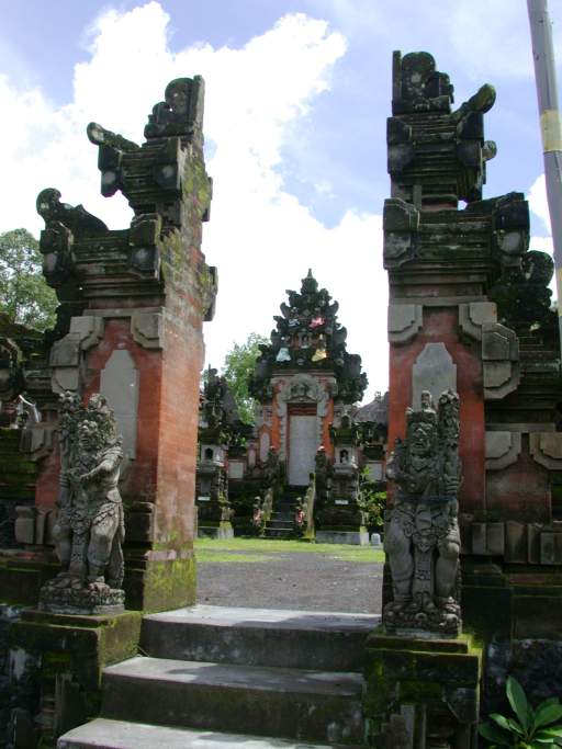
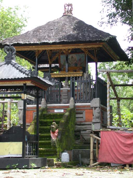
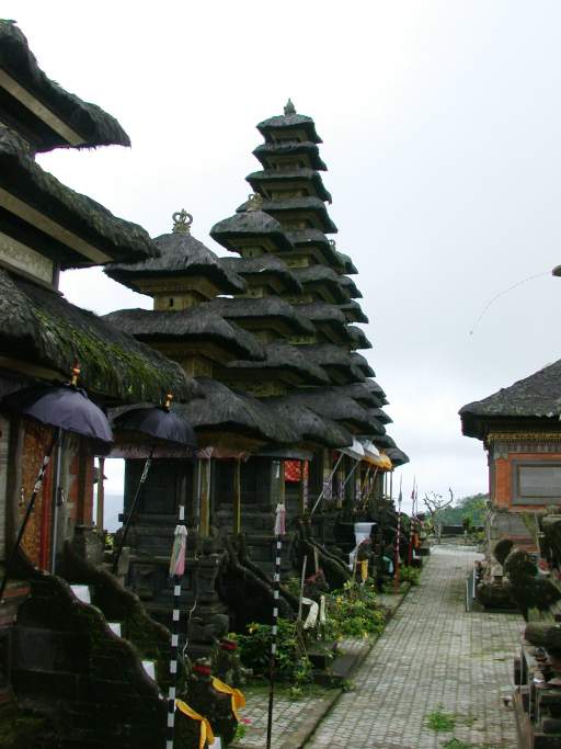
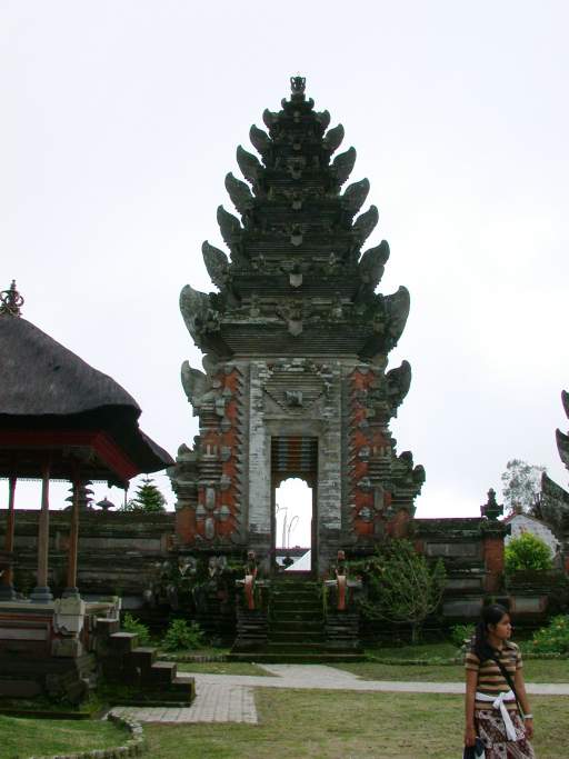
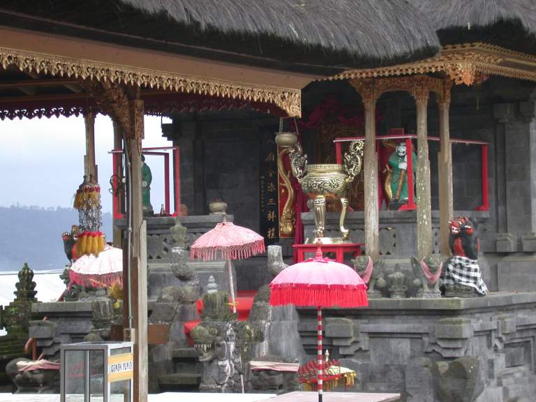
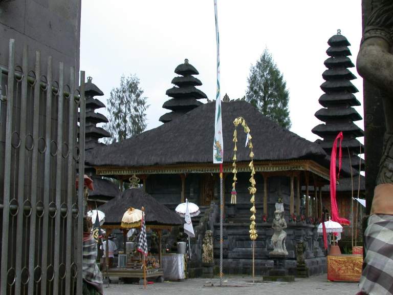
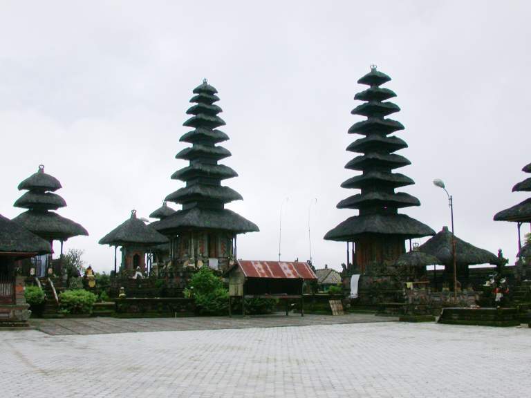
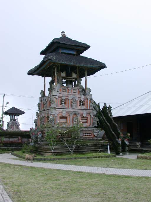
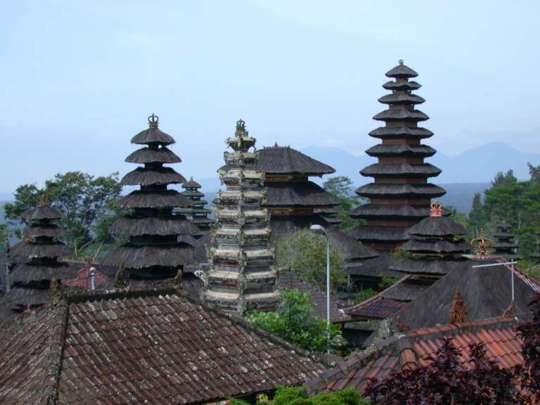
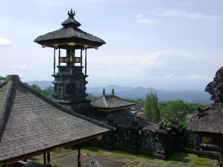
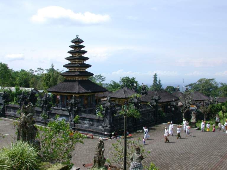
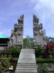
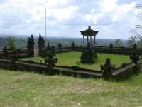
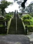
At the northwest corner of the central crater
is another temple,
Pura Tegeh Kuripan.
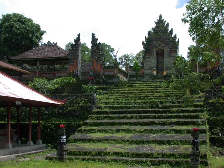
Many of the temples are built on the highest ground possible,
to be nearer to the Gods.
Getting to them is usually an exercise, literally,
requiring climbing a bunch of steps.
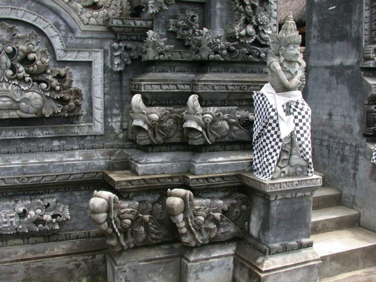
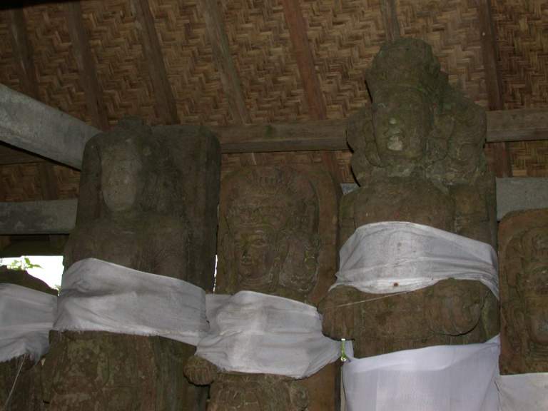
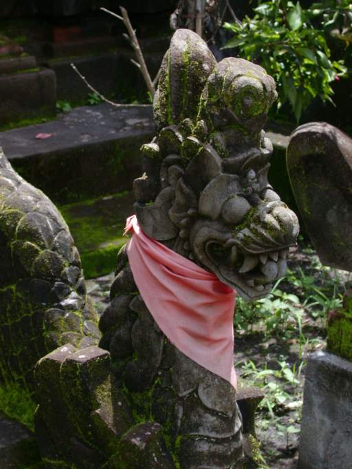
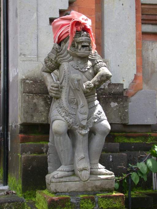
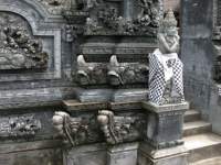
The hindu temples had little in the way of expensive, flashy decorative ornamentation.
Instead, they usually were covered with intricate stone carvings.
In many cases, the covered structures in the temple
protected ancient stone carvings.
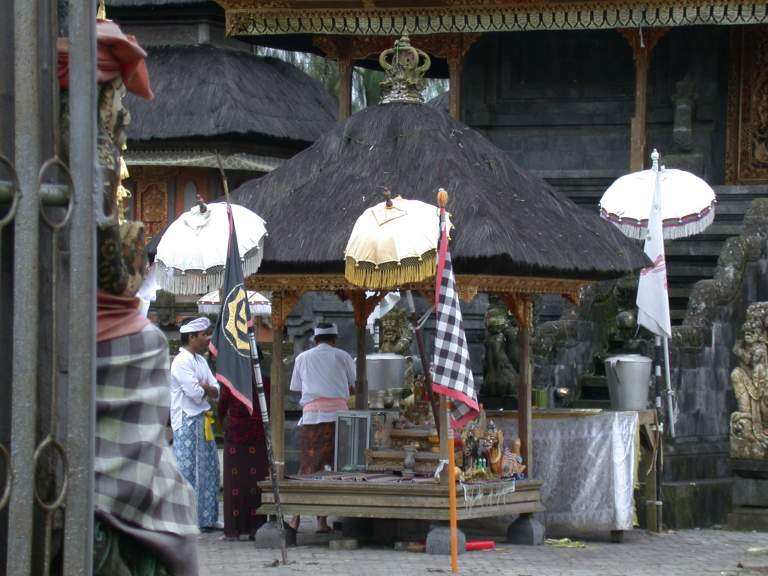
While sitting on the steps contemplating the world,
a bemo (local mini-bus) drove up and a woman and her family got out.
They purchased some blessings from the man at the temple gate,
then kneeled on the pavement outside the gate and prayed.
After a few minutes, they got back in the bemo and continued on.
I was surprised.
They came a long (for them) way to this temple to pray,
and never actually entered it.
 |
 |
 |
 |
 |
| Pura Tegeh Kuripan entrance |
Pura Tegeh Kuripan |
Guardian statue at gate |
|
Statues under temple roof |
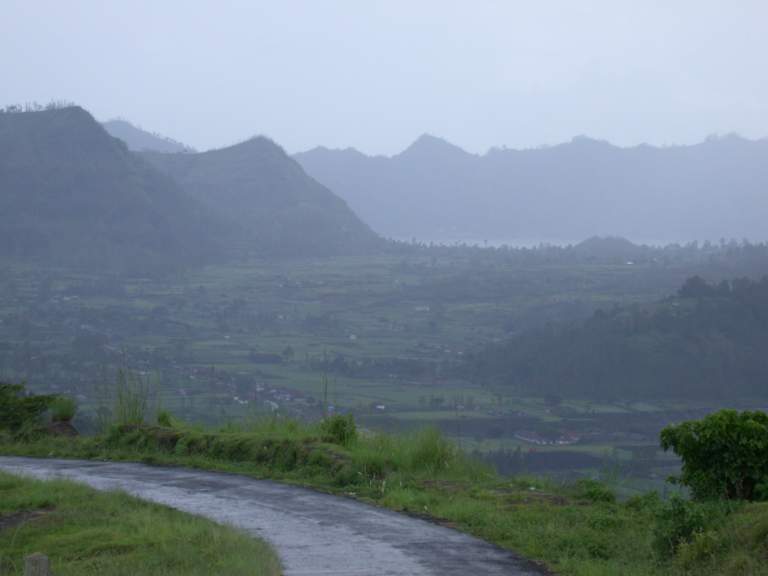
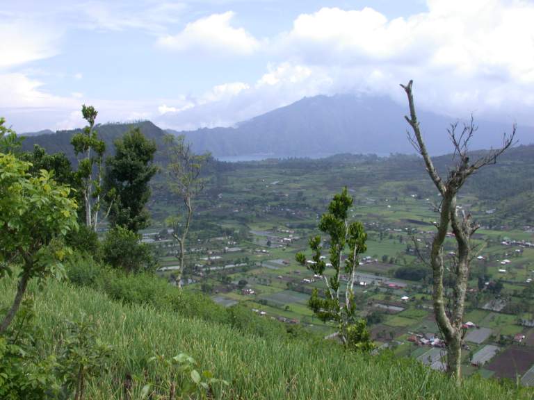
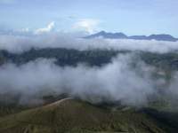
The clouds were piling up,
and the weather looked ominous.
From Pura Tegeh Kuripan,
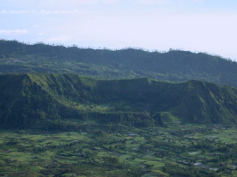
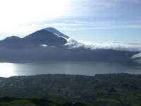
I headed into the humongous crater of central Bali.
From Pura Tegeh Kuripan I headed down into the massive crater of an old volcano.
Big time down, as the temple sits at a high point on the old crater rim..
It had started raining, and the roads were slick.
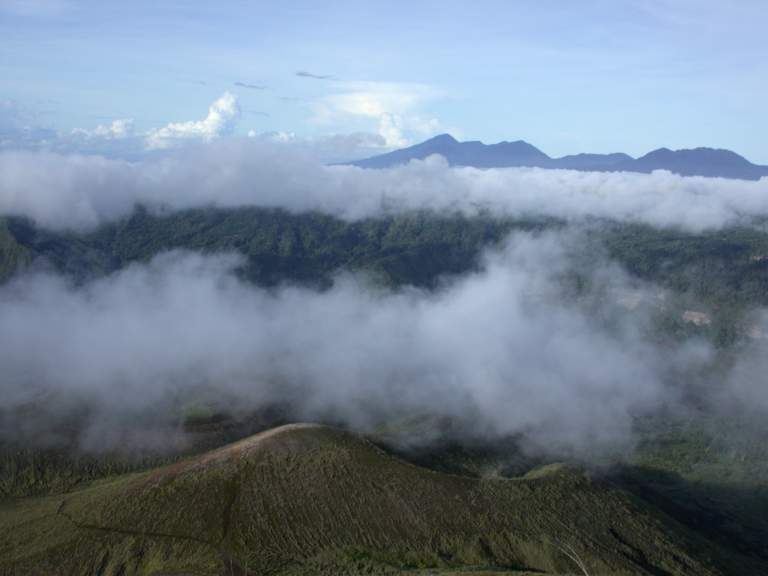
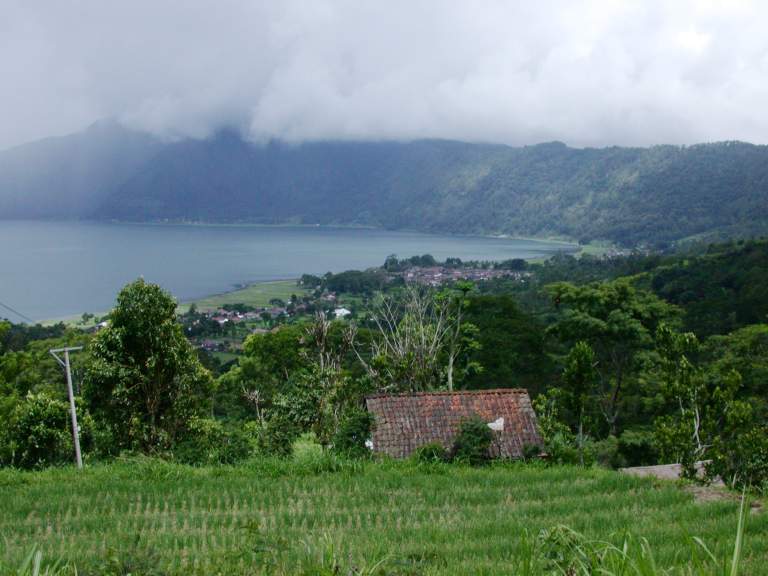
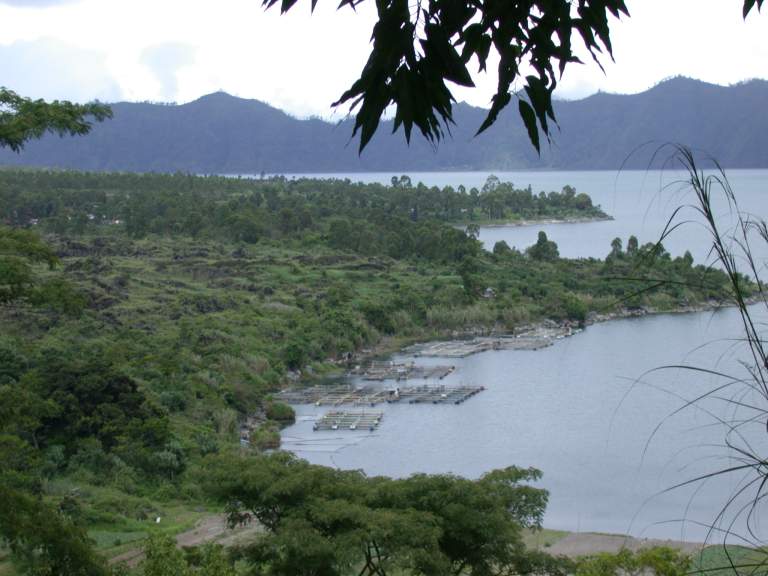
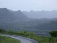
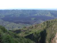
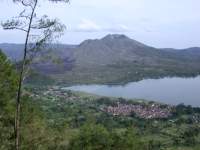
The crater seemed huge, ten or twelve kilometers across.
The view was spectacular.
The inside of the crater is covered with green;
small towns and fields cover most of the tillable ground.
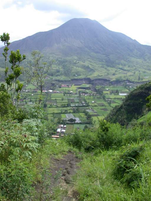
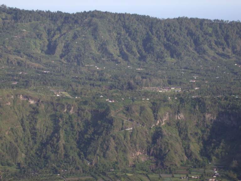
Inside the crater, next to the rim but about half way to the bottom,
is a broad plateau;
It looks like the original volcano erupted again,
on a smaller scale, and left a plateau of lava outside the smaller cone.
Inside the smaller cone / plateau,
down on the crater floor,
another volcano has risen,
presumably a reincarnation of the original.
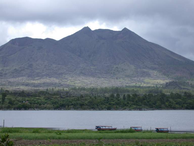
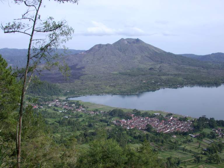
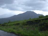
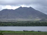
The new, little volcano, is named Gnung (Volcano?) Batur.
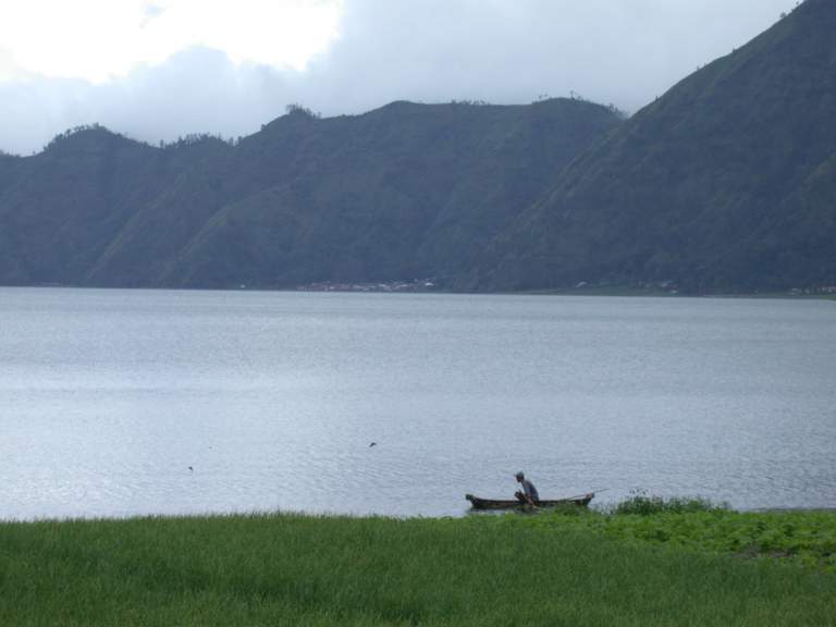
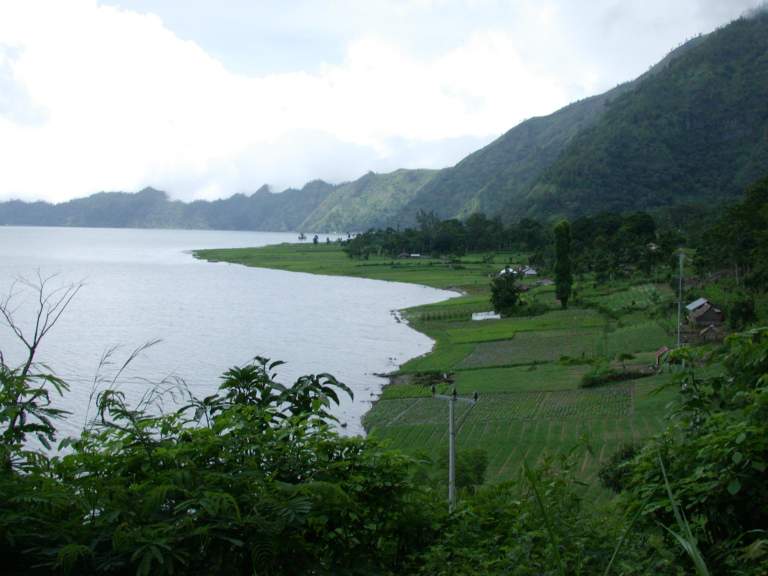
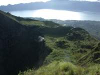
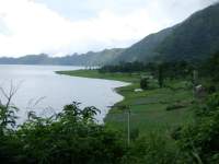
About a quarter of the old volcano is now occupied by a lake, Danu (Lake) Batur.
Lake Batur was on the far side of the crater from where I started,
and behind it,
with one side being the wall of the old volcano,
rose another volcano, Gnung Abang.
This is definitely part of the "Ring of Fire".
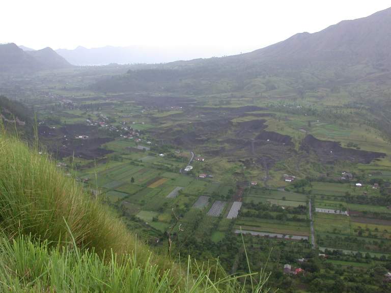
G. Batur blew up a few years ago, and there is a large lava flow
down one side and out into the old, larger, crater.
There is also a huge excavation scar,
from which a constant stream of dump trucks emerges,
hauling fine volcanic topsoil out of the crater and down to Denpasar.
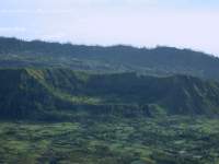
On my map, there is a small road that circles the old crater on the inside.
I decided to take it, as half the roads I had traveled on so far
weren't even on the map, and most of them weren't too bad;
almost all were paved.
The road switchbacked down the inside wall of the old crater,
onto the plateau formed outside the middle crater.
The road was so steep I was seriously worried about losing the bike
because it was so slick.
We did a bit of slipping and sliding,
but fortunately only for very short blips.
As I worked my way down and around the rim,
I could see I was getting squeezed between the rim and the edge of the plateau
I was on.
The road deteriorated as we went,
and eventually turned into a dirt trail.
I persevered, but eventually had to turn around
where it became little more than a path littered by large volcanic boulders.
I back tracked to the closest fork,
another steep road that switchbacked down the inside of the middle crater
to the very bottom, where the excavation was.
From there I wound my way over to the lake,
and then through peaceful countryside to the town of Toya Bungkah.
 |
 |
 |
 |
| G. Batur from old crater rim |
G. Batur, D. Batur in distance |
Excavation in crater bottom |
Crater bottom |
 |
 |
 |
 |
| Crater rim, lake Batur, G. Abang |
Crater floor |
Crater floor, G. Abang |
Heading down |
 |
 |
 |
| Looking back to road down |
Approaching Lake Batur; crater rim |
Approaching Lake Batur |
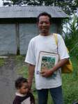
As I neared the lake, I stopped at a small store to fill up on gas.
There I met Koman,
who told me about a good inexpensive place to stay in Toya Bungkah,
and also told me where one of the trails up to the top of Gnung Batur started.
I was hoping to climb at least a small volcano while here,
as it seemed like there should be a great view from the top of any of them.
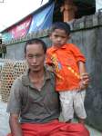 |
| Koman and son |
As I headed for my hotel,
I was constantly stopped and offered
trinkets,
massages and I'm sure more,
dinner at various restaurants,
and hotels.
People wanted to know where I was staying,
hoping to guide me there and get a small tip for the service.
It was sad to see these energetic people scrambling so hard
just to make ends meet,
almost their entire economy collapsed as a result of the bombs
at the glitzy plastic tourist area south of Denpasar.
Once checked in at my hotel,
clothes changed and hung out to dry,
I inquired about climbing the small volcano, Gnung Batur.
I was innundated with offers for guides to help me,
for $25 and up.
That was more or less my budget for a whole day,
and seemed like an awful lot to walk up a small hill
I could see out the back door,
and which would only take a few hours up and back.
I got on the bike and wandered down the road a bit
and eventually found what looked like a good place to start up the mountain.
The next morning,
I jumped up,
looked out to see if it was reasonably clear (it was),
grabbed my camera,
hopped on the bike,
and zipped down the road to where a trail
(one of many, I discovered as I went up)
headed off towards the volcano.
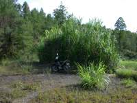
I rode the bike up it as far as seemed reasonable,
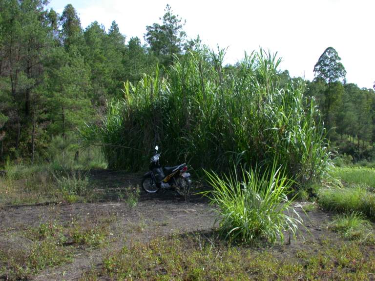
then parked it behind a small clump of something that looked like humongous grass.
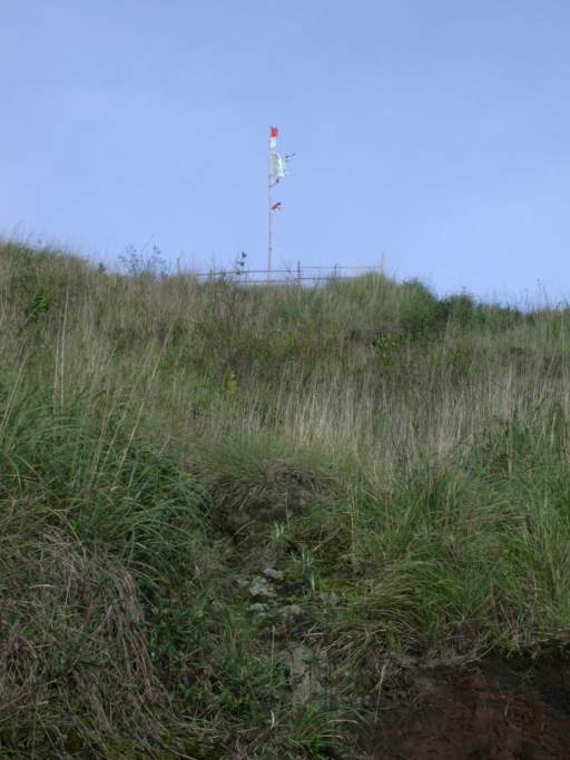
It took about an hour to get to the top,
I followed a trail about half way,
then scrambled up a small ridge to the rim of the crater
on one side of a large hole in the side of the volcano where it had blown out.
I followed that ridge up to the top.
 |
 |
| Bike at the bottom |
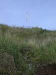
Looking up to flag on crater rim |
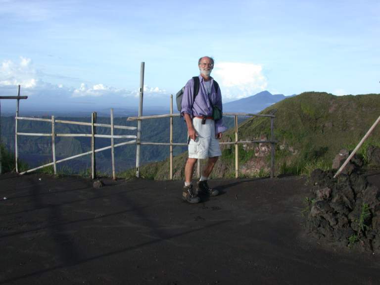
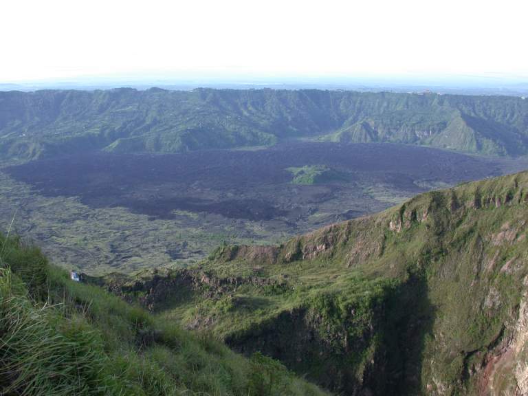
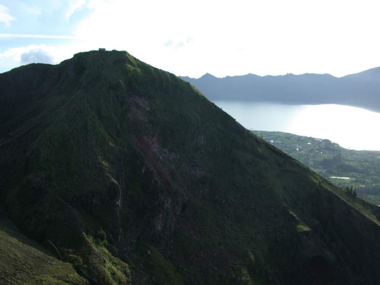
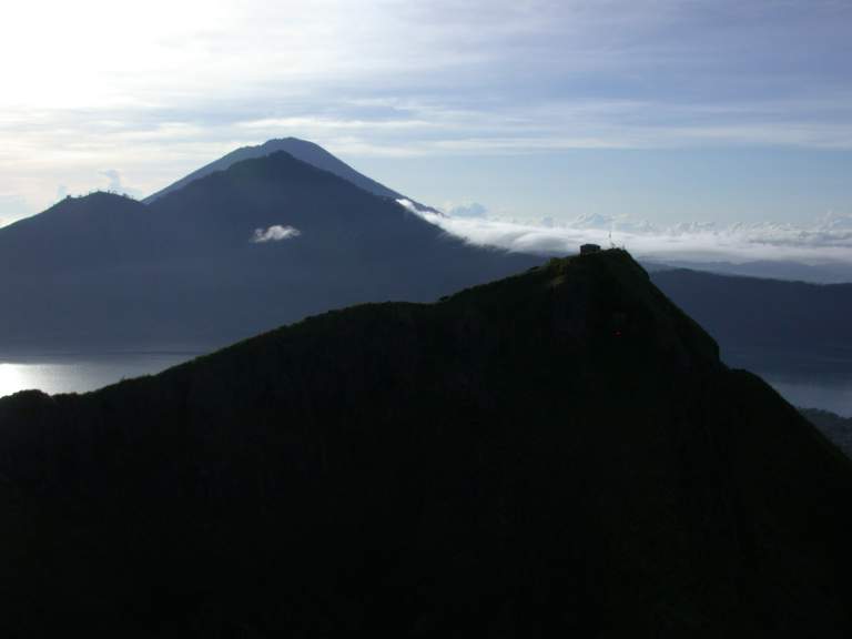
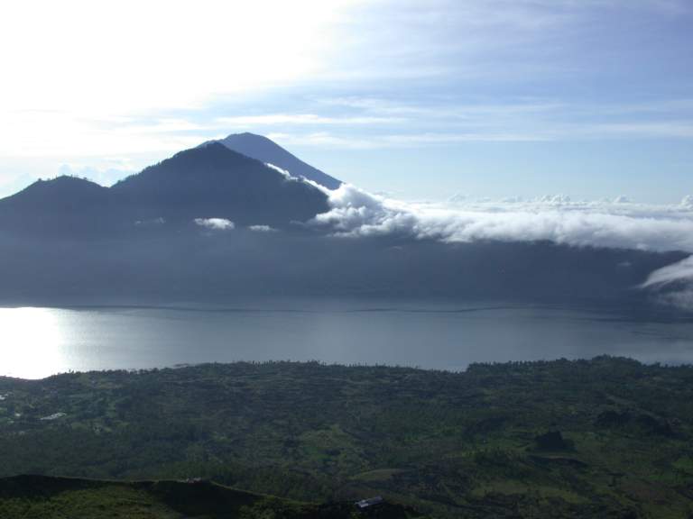
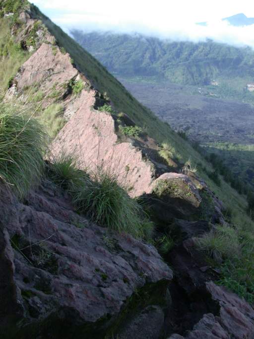
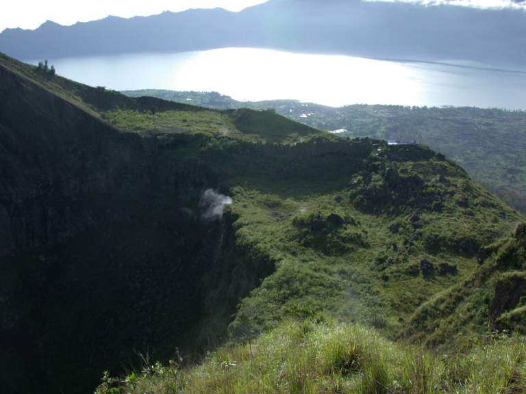
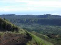
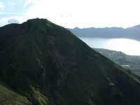
The view from the top was awesome.
In the picture below, the lake (Danu Batur)
occupies the eastern third of the old crater.
The volcano centered behind the lake,
on the old crater rim,
is Gnung Abang.
Behind Gnung Abang, barely visible, is Gnung Agung,
the highest volcano / highest point on Bali.
The crater rim continues behind me about as far as it lies in front.
Toya Bungkah, the town where I was staying,
is dead center in front of me on the lake's nearest edge.
My original attempt to get to the bottom
was following the crater rim on the far left.
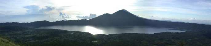 |
| A Crater within a Crater |
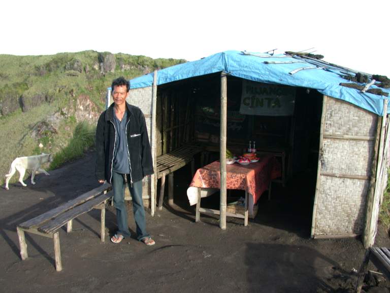
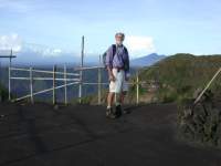
When I got to the top,
there was a small hut occupied by a man
who had cokes, coffee, and tea for sale,
as well as bananas and some candy.
I bought something from him,
just because I felt sorry for him.
He got up every day at 4:00 and hauled that stuff up here to sell.
There weren't many visitors to Bali this year,
let alone ones who wanted to climb a volcano.
 |
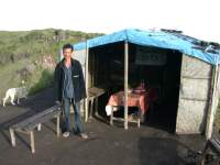 |
| Gary on crater rim |
Vendor on crater rim |
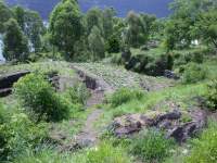
I hiked around the rim of the crater.
I could see the lava flow from the eruption of this volcano a few years before,
and the rim of yet another small volcano across the valley.
 |
 |
 |
 |
| Outside rim and lava floe |
Yet another volcano |
Outside rim and middle plateau |
Outside rim, plateau, and bottom |
In the middle photos below,
the hut at the top in the foreground is where the guy selling coffee was;
I reached to rim near the lower right corner on the ridge,
and climbed up to the hut,
then continued on around to where the photo was taken.
The large gap between where I stood to take the photos
and the hut on the other side
is where the volcano blew out its side.
 |
 |
 |
 |
| Fancy hotel on outside rim |
Lake Batur, ridge I came up |
Hut on Batur, Lake Batur, Gnung Abang, Gnung Agung |
Lake Batur, Gnung Abang, Gnung Agung |
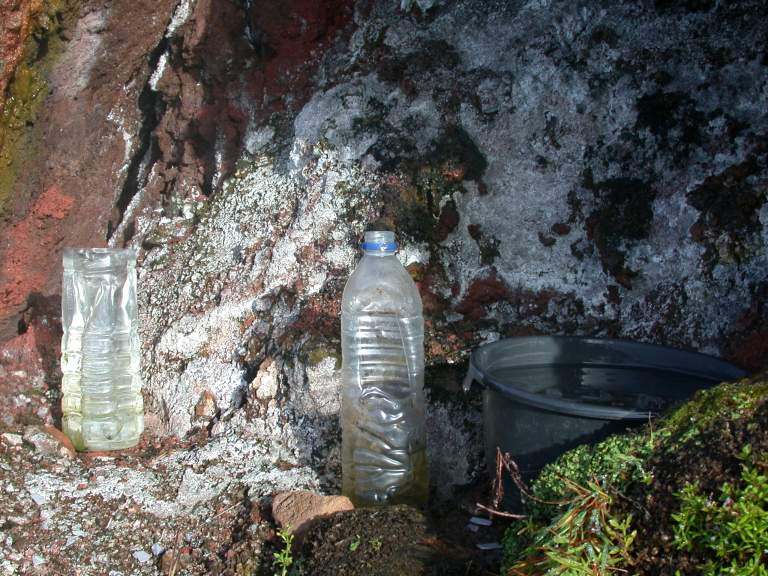
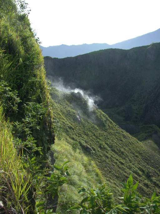
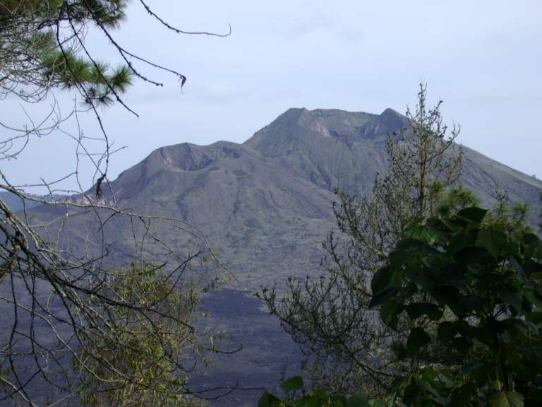
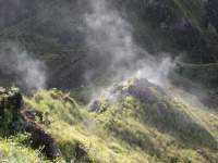
Batur is an active volcano,
and there are numerous steam vents inside the crater.
I hiked down to one just inside the rim
where people had left a pot to collect dripping hot water.
 |
 |
 |
 |
| Hot water at steam vent |
Steam from vents |
Steam vent |
Steam vent |
 |
 |
 |
| Rim of Gnung Batur |
Clouds rolling in |
Hole in crater wall |
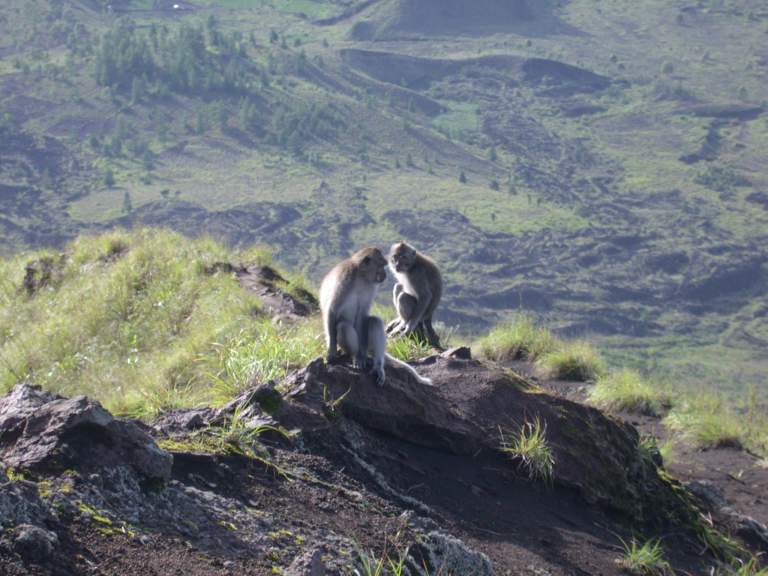
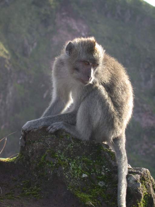
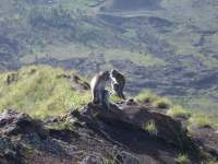
There were some macaques hanging out on the crater rim,
clearly used to begging from hikers.
 |
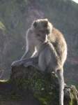 |
| Macaques |
Macaque |
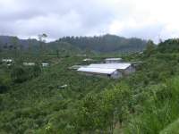
The next day I explored around the crater on the bike.
It was amazing how every piece of usable ground was growing something;
tiny vegetable gardens in the midst of a jumbled floe of lava;
tiny rice paddies in a small depression.
 |
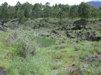 |
| Small garden |
Tiny rice paddy |
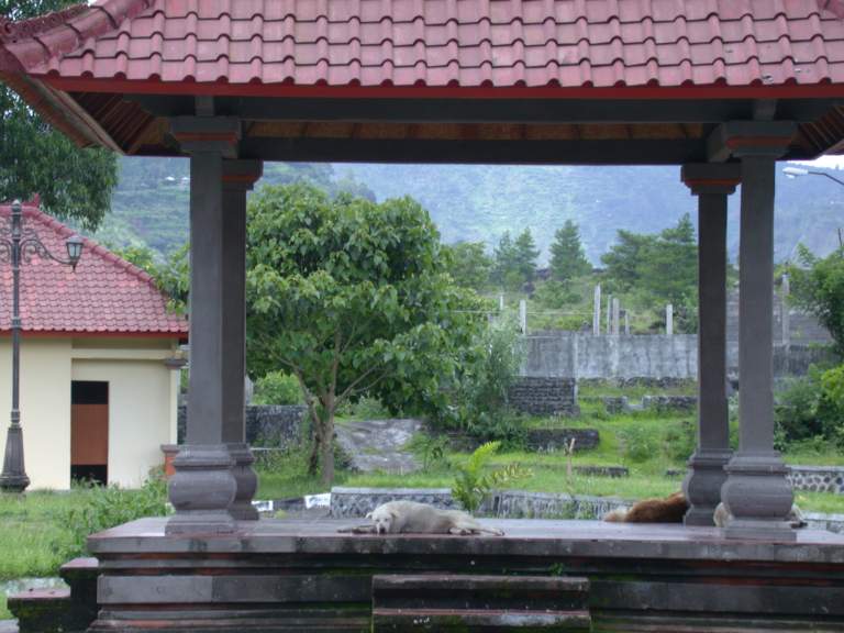
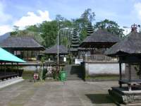
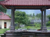
There is a temple near the lake, Pura Jati,
and I stopped to check it out.
There seemed to be more dogs in the temples than people.
They wandered around,
slept where they pleased,
and hunted for scraps left in blessings.
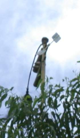
As I was wandering around,
I heard a clacking noise,
high up in a tree.
I finally found it;
a windmill driven noise maker.
It looked like it might be a scarecrow device, but I'm not sure.
 |
 |
 |
| Dogs in temple |
Clacker high in tree |
Foundations for temporary vendors |
I worked my way around the lake towards the base of Gnung Abang.
This was mostly farming villages,
squeezed onto a small area between Gnung Abang and Lake Batur.
 |
 |
 |
 |
| Lake Batur |
G. Batur and smaller sibling |
Lake Batur, G. Abang slope |
 |
 |
| School kids |
School kids |
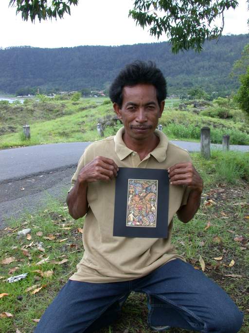
It is difficult for me to deal with street vendors;
I feel like if I even look at their stuff, I need to buy something.
As a consequence, I often try to avoid them.
But I'm a sucker,
and I'd stop to wave at someone on the side of the road and say hi,
and they'd turn out to have something to show me.
This man had some pictures I liked, so I bought a couple.
Then I crawled up a steep road out of the big crater,
and onto the rim.
 |
 |
| Artist |
Crater hillside farm |
The road followed the rim of the crater for about 15 miles,
and connected to the place where I had originally turned off to go down into the crater.
Along the way was Pura Ulun Danu, a well-known Hindu temple.
I think that means something like the temple of the lake,
but I'm not sure.
It is located right on the rim,
and has an outstanding view.
 |
 |
| Fish / crayfish pens |
Artist |
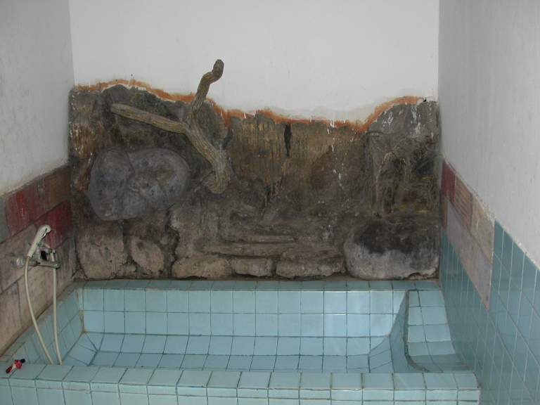
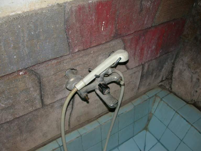
Whoever was in charge of my hotel had their priorities a bit mixed up.
They figured they needed to have something artistic to attract business,
so one wall of the bathtub was decorated with rock.
Unfortunately, they forgot that one of the more important things
is to make sure the basic plumbing worked.
The faucet had no knobs.
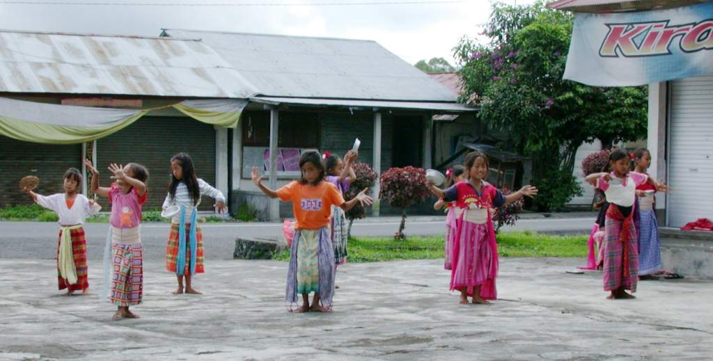
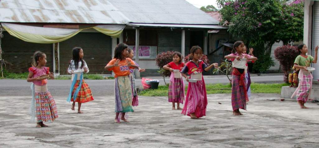
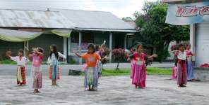
The daughter of the manager of the hotel and her friends / classmates
were practicing one of the traditional dances.
They had the whole thing memorized,
and were pretty darn good considering their age.
 |
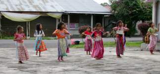 |
| Kids practicing traditional dances |
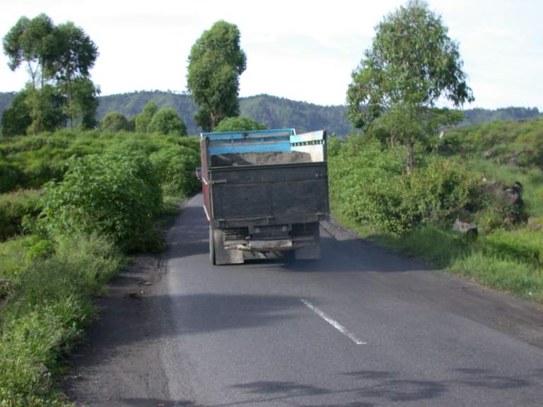
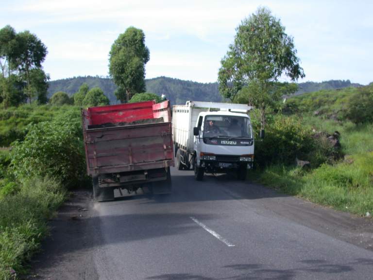
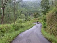
As is obvious from the pictures,
the roads in Bali are narrow.
In many cases, the lanes aren't wide enough for a car.
Put a couple of dump trucks, even small dump trucks,
on the roads, and it's almost comical.
They hardly slow down to pass.
 |
 |
| Truck lane |
Passing zone |
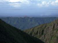
As I looked across from the outer rim to Gnung Batur,
the volcano I climbed, I got a great view of its smaller sibling,
the volcano responsible for the recent lava floe.
 |
 |
 |
| G. Batur and sibling |
G. Batur, sibling, Lake Batur |
| Lake Batur, G. Abang |
|
I left the Batur area and headed towards Candi Dasa,
a seaside village on the southeast coast where I would meet up with Wayne.
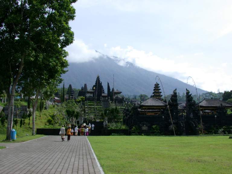
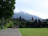
This took me around the foot of Gnung Agung, the highest peak.
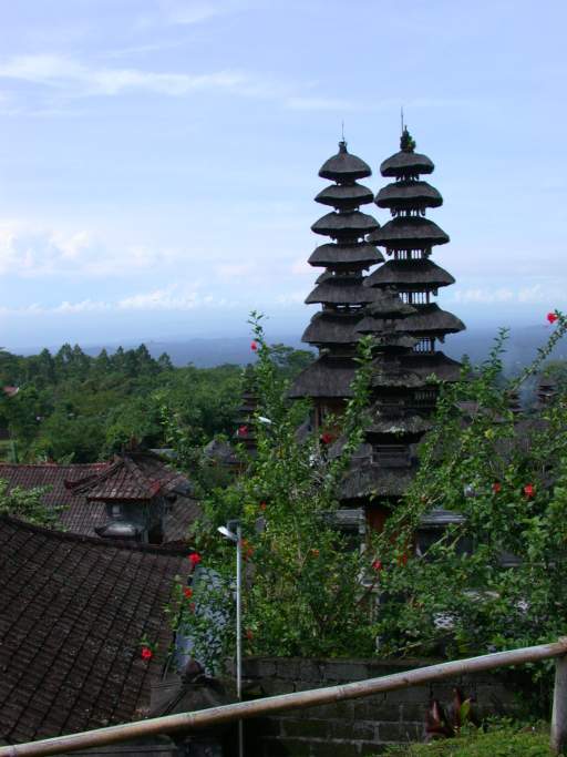
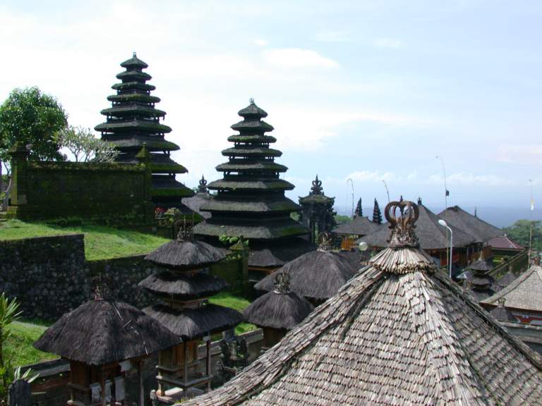
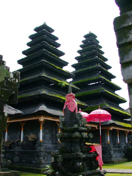
On its side is Pura Besakia,
another well known Hindu temple in Bali.
Unfortunately, it is too well known,
and the locals have made it rather like disneyland,
charging exhorbitant prices just to see it.
Don't go to the main entrance;
walk around to the side and patronize someone a little less demanding.
 |
 |
 |
| Cages protecting new trees |
Gnung Agung |
Pura Besakia and Gnung Agung |
From Pura Besakia it was downhill all the way to Candi Dasa,
where I hooked up with Wayne again.
 |
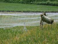 |
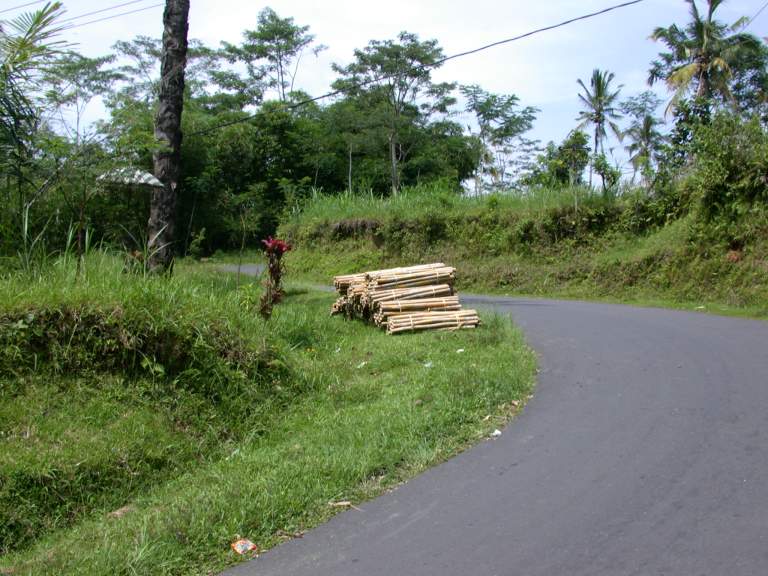
| Bamboo freight pickup |
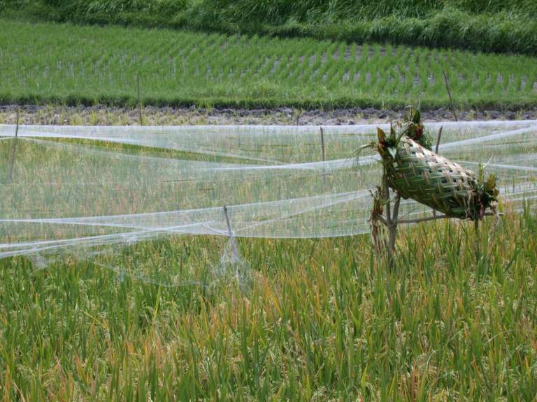
Netting protecting rice |
Candi Dasa (next)
North Coast Wandering (previous)